This guide contains affiliate links. We may earn a commission at no extra cost to you — see our Affiliate Disclosure and Affiliate Disclosure Policy for details.
Discover the Samuel H. Boardman hidden gems along Oregon’s southern coast, from dramatic sea arches and secluded coves to scenic viewpoints and coastal trails. This guide covers the best stops, practical driving tips, and advice to help you plan your visit.
Samuel H. Boardman State Scenic Corridor stretches for about 12 miles along Highway 101. The Oregon Coast Trail follows a longer route through the corridor, with an approximately 18-mile segment connecting trail sections and viewpoints. The 12-mile figure describes the park’s coastal stretch, while the 18-mile figure refers to the trail route—not the length of the park itself. Check the official Oregon State Parks page and trails and viewpoints brochure for planning details.
A quick note on accuracy: I checked official park pages, operator websites, and review platforms in mid-October 2026. Prices, hours, ratings, trail conditions, and seasonal schedules change often, so treat this guide as a planning tool and confirm the details that matter before you leave.
Table of Contents
About the Corridor
A Short History of the Corridor
This park exists because of one stubborn idea. Samuel H. Boardman (1874–1953) was Oregon’s first state parks superintendent, serving from 1929 to 1950, and he dreamed of a great coastal park in Curry County. In the early 1940s he even pitched a national park along this coastline to the US Secretary of the Interior. Federal officials toured the area, but the national park never happened.
The state assembled the land mostly between 1949 and 1957, buying parcels from private owners and the Bureau of Land Management. In 1950, Borax Consolidated, Ltd., of London donated more than 300 acres for the park, plus land for the relocated coast highway. The park was named for Boardman as a tribute when he retired, and a monument was dedicated at House Rock Viewpoint in 1970.
People were here long before any of that. Oregon State Parks reminds visitors that Native Americans, explorers, gold seekers, and settlers all walked the same worn paths over the millennia. You can read the park’s official summary on the Oregon State Parks page for the corridor.
Geography: Cliffs, Sea Stacks, and Hidden Coves
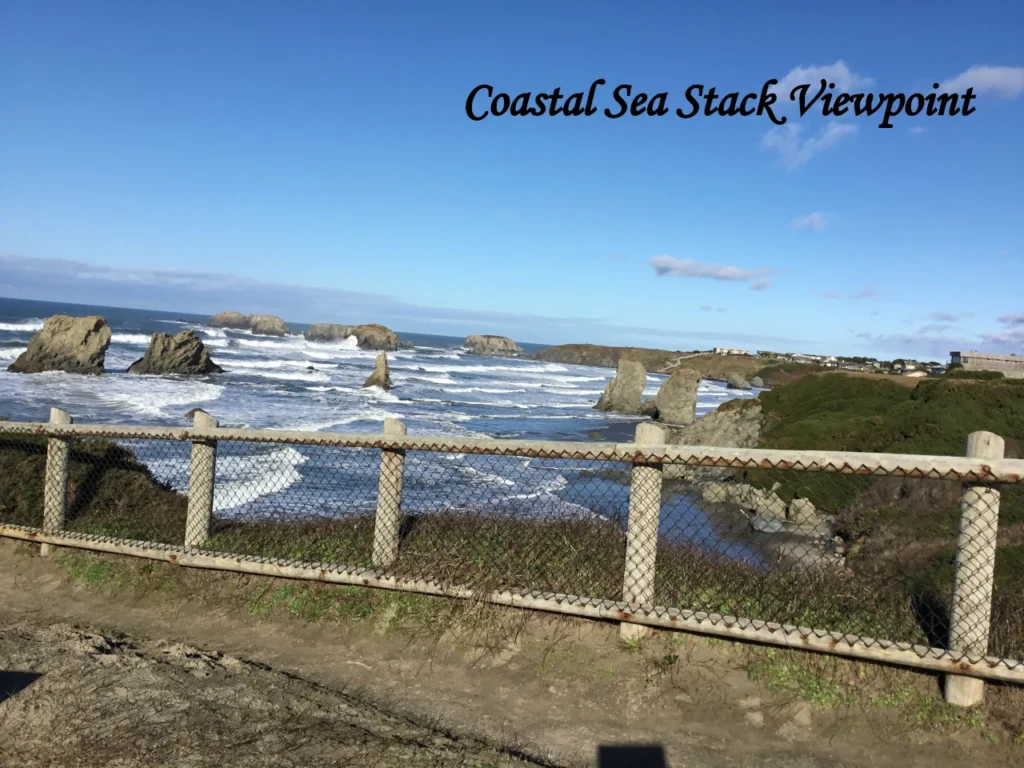
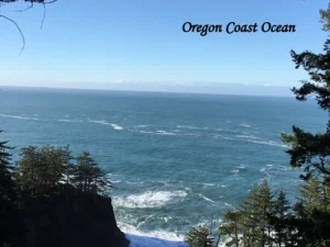
The corridor is a narrow ribbon of public land squeezed between Highway 101 and the Pacific Ocean. The Oregon Coast Visitors Association describes it as a forested, linear park with a steep, rugged shoreline broken up by small sand beaches. Each pullout along the highway leads to a picnic area, a viewpoint, or a trailhead, and many connect to the Oregon Coast Trail.
Walk any trail and the scenery shifts fast. You might cross a seaside prairie, slip into shady forest (the Oregon Coast Visitors Association says some of the Sitka spruce here are about 300 years old), and then arrive at a cliff edge with sea stacks scattered offshore. Wind-sculpted sandstone at Indian Sands, hidden coves below the bluffs, and natural arches at Natural Bridges make this one of the most varied stretches of the southern Oregon coast.
8 Hidden Gems Attractions in the Boardman Corridor
Some of these eight stops, like Natural Bridges and Thomas Creek Bridge, draw the crowds. Others are quieter corners most visitors drive past. Each stop below is rated for how ‘hidden’ it really is. The effort descriptions below are intended as general planning guidance, not official trail difficulty ratings. Walking time and trail conditions vary with the route, weather, terrain, and individual ability. Check current park information before beginning a hike.
Explore these hidden gems, scenic viewpoints, and coastal trails to discover some of the most memorable places along Samuel H. Boardman State Scenic Corridor.
1. Arch Rock
Arch Rock is a gentle opener. From a paved parking lot, a short path leads to an overlook with a series of offshore sea stacks and islands. On calm days, the namesake arch is visible to the north. It also sits on the Oregon Coast Trail, so hikers often use it as a northern access point.
- Accessibility: Arch Rock has a paved parking area and a short paved path to the overlook. These features do not, by themselves, confirm that every part of the viewing area is wheelchair-accessible. Visitors who require step-free access or specific accessibility facilities should check the current information with Oregon State Parks before visiting.
- Photography: Sunrise and early morning bring soft light and fewer people. A telephoto lens helps isolate the sea stacks.
- Safety: Stay behind the established viewpoint edge. Wind and spray can make the rocks slick.
It has a paved lot and a short walk to the overlook, so it is one of the easiest and most visited stops on the corridor.
2. Secret Beach, Oregon
The next Hidden Gem is the Secret Beach lives up to its name. A short trail drops through forest, crosses a small creek, and ends at a cove ringed by sea stacks. Depending on conditions, a small waterfall spills onto the sand near the north end, and harbor seals sometimes rest on the rocks. Plan on about a mile round trip, with a rocky descent and an unsigned junction.
- Accessibility: Not suitable for strollers or wheelchairs. The climb back up is the hard part, so leave extra time.
- Photography: Low tide reveals the most beach and the best foreground. Late-day light is lovely, but do not cut your time close.
- Safety: The beach can be cut off at high tide. Check NOAA tide predictions first, keep an eye on the surf, and never turn your back on the ocean.
The steep, rocky descent of about a mile round trip and the high-tide cutoff keep casual visitors away.
3. Natural Bridges, Oregon
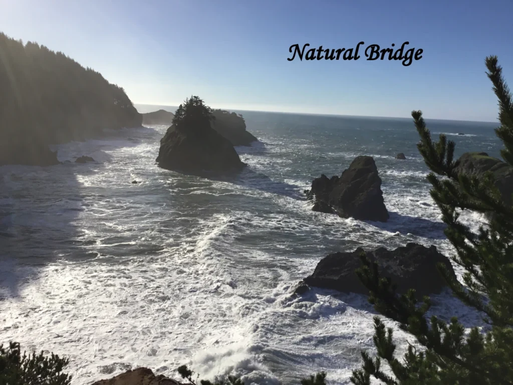
Natural Bridges is the signature stop of the corridor. A short trail leads to one of the park’s best viewpoints, overlooking a cluster of sea arches and blowholes carved by centuries of wave action. A memorial here honors Dr. Samuel Dicken, who first envisioned the Oregon Coast Trail. It is roughly half a mile (0.8 km) round trip, but the overlook sits at a cliff edge with no railing.
- Accessibility: Short but uneven trail. Treat it as an easy walk with a serious drop-off, not a fully accessible viewpoint.
- Photography: Late afternoon is popular because the sun can light the openings in the arches roughly an hour before sunset.
- Safety: Never climb on the arches or step beyond the established viewing area. Hold toddlers and keep dogs leashed and close.
It is the corridor’s signature stop, and the short half-mile trail makes it popular, especially for late-afternoon photos.
4. Indian Sands trail
Indian Sands looks nothing like the rest of the corridor. The trail opens onto wind-carved sandstone that feels almost like high desert, then loops back through low coastal forest with ocean views most of the way. Expect a moderate loop of about 2 miles (3.2 km), often 90 minutes or so.
- Accessibility: Uneven, exposed, and not stroller-friendly.
- Photography: Wide-angle lenses suit the sculpted sandstone. Early morning light is softer and the wind is often calmer.
- Safety: Footing on the sandstone can be loose, so wear shoes with grip. Stay on the established route, keep well back from edges, and skip this hike in strong wind.
The roughly 2-mile loop of uneven, exposed terrain takes about 90 minutes, so many drivers pass it by.
5. Whaleshead Beach
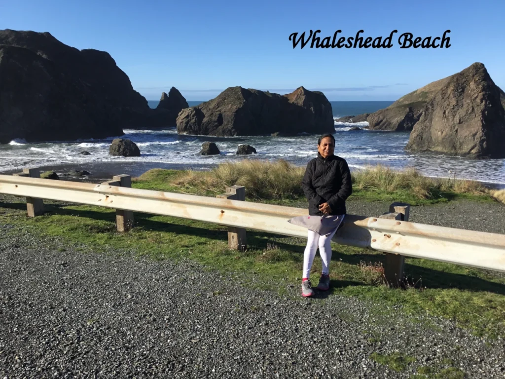
Whaleshead Beach is one of the friendliest stops in the park. Oregon State Parks describes an oceanfront picnic area with gorgeous views and an easy, flat path to the beach. The name comes from an offshore rock said to resemble a breaching whale. The overlook is also a favorite perch for whale watching in winter and spring.
Gray whales can be seen along the Oregon coast throughout the year, although sightings vary by season. The main southbound migration occurs from mid-December to mid-January, while northbound migration begins in late March and continues through spring. Resident gray whales may also feed close to shore during summer and fall. Oregon State Parks specifically highlights Cape Ferrelo Viewpoint for whale watching in fall and spring. Whaleshead Beach is another scenic place to look out to sea, but sightings are never guaranteed. Check the official Oregon State Parks whale-watching guide before your visit.
- Accessibility: Official descriptions call the path easy and flat, which makes this a good option for families. Confirm current conditions before you go.
- Photography: Sunset light on the rocks and the curve of the beach is the draw.
- Safety: Surf can be powerful, and sneaker waves are possible on open beaches. Keep little ones well above the waterline and watch for drift logs.
The flat path and picnic area make it easy to reach, but it gets less attention than the big-name overlooks.
6. House Rock Viewpoint
House Rock is the quick-stop champion. Oregon State Parks calls it a very nice spot to look up the coast, and it has a memorial plaque for Samuel H. Boardman. The Oregon Coast Trail runs in both directions from here. The stairway to the overlook may be a barrier for some visitors with disabilities.
- Accessibility: A stairway leads to the overlook, so this stop is not step-free.
- Photography: Frame the coastline looking north. Try early morning for gentler contrast.
- Safety: Take stairs slowly when wet, and keep children close to the railing side.
It is a quick stop with a memorial plaque that many people skip on the way to the headline sights.
7. Cape Ferrelo Viewpoint
Cape Ferrelo is the spot for big views and sunsets. Oregon State Parks describes a hike of about a mile leading to a dramatic headland, and it is considered an excellent place to watch whales in fall and spring. In early summer, the open meadow along the way can burst with wildflowers.
- Accessibility: Unpaved meadow trail. A baby carrier works better than a stroller.
- Photography: Wildflowers in June and July, and golden-hour sunsets year-round when skies are clear.
- Safety: Side paths lead down toward the rocks. Skip them if the ground is wet, and keep a safe distance from any edge.
The meadow trail of about a mile leads to a dramatic headland, and it sees far fewer visitors than the roadside stops.
8. Thomas Creek Bridge
At 345 feet (105 m) above the creek, Thomas Creek Bridge is the highest bridge in Oregon. Many drivers cross it without realizing it. Two small pullouts near the bridge let you step out for a look at the canyon and the steel span. This is a roadside stop, not a destination to linger at.
- Accessibility: Informal roadside pullouts rather than developed viewpoints.
- Photography: Shoot from the pullout looking back at the span. Overcast days can add mood.
- Safety: Highway 101 traffic moves fast, and pullouts can be tight. Never stop on the roadway, and keep kids away from traffic.
A roadside landmark on nearly every list, reached from informal pullouts on Highway 101.
Also Visit our Travel Guide : Chandelier Drive-Thru Tree: 10 Amazing Travel Tips which is about 200 miles from Samuel H. Boardman State Scenic Corridor
All Images are Original were taken using iPad camara during the Road Trip of Jayanthan Solomon family and deeply researched by Hema before the Post was created. All information and Data verified Oct 2026
Hiking and Outdoor Activities Along the Southern Oregon Coast
Hiking here is less about one big trail and more about stringing together short walks. The Samuel H. Boardman hiking trails range from paved overlooks to steep, rooty descents, so match the stop to your group.
Easy Viewpoint Walks vs. Steep or Challenging Trails
| Stop | Effort | What to expect |
|---|---|---|
| Arch Rock | Easy | Short paved path to an overlook |
| House Rock Viewpoint | Easy (stairs) | Short walk with a stairway to the overlook |
| Whaleshead Beach | Easy | Picnic area and an easy, flat path to the beach |
| Natural Bridges | Easy but exposed | About 0.5 mile (0.8 km) round trip with an unfenced cliff edge |
| Thomas Creek Bridge | Roadside stop | Small pullouts beside fast traffic |
| Cape Ferrelo Viewpoint | Easy to moderate | About a mile of unpaved meadow trail, with optional side paths |
| Secret Beach | Moderate to steep | About 1 mile (1.6 km) round trip, rocky descent, creek crossing, tide-dependent beach |
| Indian Sands | Moderate | About 2-mile (3.2 km) loop on loose sandstone, exposed to wind |
The Oregon Coast Trail
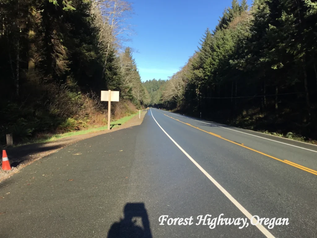
The corridor includes an 18-mile (29 km) segment of the Oregon Coast Trail, and trailheads are scattered along the highway. Oregon State Parks suggests two approaches: pick one trailhead and spend the day on a section, or stop at each parking area and explore its features. One popular stretch is the 4-mile (6.4 km) route between Cape Ferrelo and House Rock, with side trails to secluded beaches. Learn more on the Oregon Coast Trail page from Oregon State Parks and download the official trails and viewpoints brochure for the map (the brochure is older, so confirm current conditions).
Wildlife Watching, Photography, and Picnicking
Bring binoculars. Gray whales pass offshore during their migrations, and Oregon State Parks highlights Cape Ferrelo for whale watching in fall and spring. Harbor seals sometimes haul out near Secret Beach. Keep a respectful distance from any wildlife, and never feed animals. For photographers, the corridor faces west, so sunsets can be spectacular from nearly every viewpoint.
For a relaxed meal outdoors, Whaleshead Beach has an oceanfront picnic area, and Arch Rock has picnic tables. Pack out everything you bring. If you want a tide-pool walk, plan it around low tide and wear shoes you don’t mind getting wet.
Also visit our travel Guide : Humboldt Redwoods State Park: Amazing Travel Guide 2026 which about 145 mils from Samuel H. Boardman State Scenic Corridor
Best Time to Visit Boardman Corridor Hikes
Oregon State Parks says the corridor is open for day use year-round. What changes is the weather, the light, and the crowds.
Seasonal Weather and What to Expect
- Summer (roughly June–August): Drier weather and long days make this the easiest season for hiking. Expect more visitors at Natural Bridges and fuller pullouts. Coastal fog and wind can still roll in, so pack layers even on a warm day.
- Fall (September–October): Often calmer and quieter, with golden light. Fall is also one of the periods Oregon State Parks mentions for whale watching at Cape Ferrelo.
- Winter (November–March): Storms bring dramatic surf, strong wind, and slick trails. It is a stunning time to visit, but you should be flexible and stay well back from the water.
- Spring (April–May): Changeable weather, fresh greenery, and another whale-watching window. Wildflowers start to build toward their June and July peak at Cape Ferrelo.
Whale Migration Opportunities
Gray whales migrate along the Oregon coast in winter (heading south) and spring (heading north), and some linger longer. Whaleshead and Cape Ferrelo are the classic viewpoints. See the Oregon State Parks whale watching page for current guidance.
Daylight, Tides, and Forecasts
Daylight changes a lot. As a rough estimate, summer sunsets on this part of the coast come well after 8:30 p.m., while mid-winter daylight can fade around 4:30 to 5:00 p.m. Build your hikes around the clock, especially if you are climbing back from Secret Beach.
Always check the forecast and the tide table before you commit to a beach hike. The NOAA tides and currents site is the standard reference, and the official park page links to a 2026 South Coast tide table. For forecasts and warnings, start with NOAA. Before you drive, check road conditions on Oregon Department of Transportation’s TripCheck.
Suggested Itineraries for an Oregon Coast Road Trip
These time blocks are my estimates, not official figures. Driving the corridor end to end takes about 20 to 25 minutes without stops, so the real time goes to walking, photos, and traffic.
A handy driving tip: Heading south keeps the ocean on your right, which makes turning into oceanside pullouts easier. Plan your route so you do most of your stops on the southbound leg. For stop order, use the map in the official brochure rather than relying on memory.
Samuel H. Boardman State Scenic Corridor: Stops in Driving Order
The following stops are arranged from south to north along Highway 101, starting near Brookings and continuing toward Gold Beach. Mileposts are approximate navigation references; follow road signs and use the official park map to confirm each access point.
| Order | Stop | Highway milepost | Parking | Walking effort |
|---|---|---|---|---|
| 1 | Cape Ferrelo Viewpoint | 351.9 | Designated viewpoint parking; confirm current access | Moderate; approximately 1-mile loop |
| 2 | House Rock Viewpoint | 351.2 | Designated viewpoint parking; confirm current access | Short viewpoint visit; longer trails nearby |
| 3 | Whaleshead Picnic Area | 349.1 | Picnic-area parking | Easy path toward the beach |
| 4 | Indian Sands | 348.6 | Designated trailhead parking; confirm access | Moderate to strenuous; sandy, exposed trail |
| 5 | Thomas Creek Bridge | 347.8 | Confirm a safe, legal stopping point | View from a safe location; do not walk on the highway |
| 6 | Natural Bridges | 346.0 | Designated viewpoint parking | Short walk to the viewpoint; terrain can be uneven |
| 7 | Thunder Rock Cove | 345.8 | Small parking area; confirm current access | Viewpoint visit; beach trail is rough and steep |
| 8 | Arch Rock Picnic Area | 344.8 | Paved parking area | Short path to the overlook |
Before travelling: Access, trail conditions, parking arrangements, and facilities can change. Confirm details using the official Oregon State Parks page and maps. Never stop on the highway shoulder unless it is specifically safe and legally permitted.
Half-Day Scenic Drive (About 4–5 Hours)
- Start: Leave Brookings in the morning and drive to the northern part of the corridor without stopping for long (about 30–40 minutes, depending on traffic).
- Arch Rock and Natural Bridges (60–90 minutes): Two iconic views near the north end. Optionally pause at Thomas Creek Bridge.
- Whaleshead Beach (30–45 minutes): Picnic or stretch your legs on the flat beach path.
- House Rock Viewpoint (15–20 minutes): A quick overlook and the Boardman memorial.
- Cape Ferrelo (45–60 minutes): Walk the meadow trail for headland views.
- Finish: Return to Brookings for lunch or an early dinner.
The current itinerary tells readers to start in Brookings, drive to the northern end first, and then visit the stops in reverse order. To make the route easier to follow, you can list the stops in the order encountered when driving north from Brookings toward Gold Beach. The official Oregon State Parks brochure gives these highway mileposts.
One-Day Sightseeing and Photography Trip Samuel H. Boardman Scenic Drive: Stops and Highway Mileposts
The following stops are arranged from south to north, starting near Brookings and continuing toward Gold Beach along Highway 101. Use the official park brochure and roadside signs to confirm each access point before pulling over.
| Stop | Highway milepost |
|---|---|
| Cape Ferrelo Viewpoint | 351.9 |
| House Rock Viewpoint | 351.2 |
| Whaleshead Picnic Area | 349.1 |
| Indian Sands | 348.6 |
| Thomas Creek Bridge | 347.8 |
| Natural Bridges | 346.0 |
| Secret Beach / Thunder Rock Cove area | Approximately 345.8 |
| Arch Rock Picnic Area | 344.8 |
Suggested driving plan: Start near Brookings and visit the viewpoints in milepost order, travelling north toward Gold Beach. Allow extra time for walking, photography, parking, tides, and trail conditions. The Secret Beach access point is approximate, so check the official map before setting out.
Official map: Samuel H. Boardman Trails and Viewpoints brochure.
- Morning: Arch Rock and Natural Bridges in soft light, then the Indian Sands loop (about 90 minutes) on a calm morning.
- Midday: Picnic at Whaleshead Beach, then House Rock Viewpoint.
- Afternoon: Secret Beach (allow 1.5–2 hours with the climb back) when the tide allows. Skip it if the tide is high or the trail is wet.
- Late afternoon: Cape Ferrelo or a second visit to Natural Bridges for golden-hour photography.
- Evening: Dinner in Brookings. If you want tide pools instead, Harris Beach State Park in Brookings is a popular alternative (note that Harris Beach requires a day-use parking permit).
Two-Day Southern Oregon Coast Getaway
Day 1: Settle into Brookings. Arrive, check in, and ease into the coast with a walk at Chetco Point Park or Harris Beach. Have dinner in town. Brookings is the most practical base because lodging and restaurants are concentrated here (see the hotel and restaurant sections below).
Day 2: Corridor, then north. Do the one-day corridor plan or a trimmed version, then continue north toward Gold Beach if you want more time on the road. Gold Beach has its own lodging if you prefer a second night there, and the Rogue River jet boat tours are seasonal, so check dates first. Keep the day flexible. Sunsets here are worth the wait.
Visiting with Young Children and Infants
Stroller and Toddler Guide
Samuel H. Boardman State Scenic Corridor is known for its dramatic cliffs, hidden beaches, coastal forests, and ocean viewpoints. Families travelling with infants and toddlers can enjoy its scenery, but some trails have steep descents, uneven surfaces, stairs, or exposed cliff edges. Choosing accessible stops and checking current trail conditions will help make your visit safer and more comfortable.
Stops That May Not Suit Strollers, Infants, or Toddlers
- Secret Beach: The trail includes a steep, rocky descent and a creek crossing, while high tides can limit beach access. It may be unsuitable for families carrying infants or travelling with toddlers.
- Indian Sands: Loose sand, exposed terrain, strong winds, and nearby cliff edges make this trail challenging for young children and unsuitable for most strollers.
- Natural Bridges: The short walk leads to a viewpoint with an unfenced cliff edge. Keep children under close supervision and remain on established paths.
- Cape Ferrelo Viewpoint: The unpaved meadow trail can be uneven, and some side paths lead toward steep coastal edges. A stroller may be difficult to manage.
- House Rock Viewpoint: Stairs leading to the overlook make this stop impractical for most strollers.
- Thomas Creek Bridge: The roadside pullouts are close to Highway 101 traffic. Keep children close and use designated parking areas rather than stopping on the road shoulder.
Family-Friendly Stops to Consider
Arch Rock offers a paved path to a coastal viewpoint, making it a convenient option for a short family stop. Whaleshead Beach has a picnic area and an easy, relatively flat path toward the beach. These locations may be more manageable for families than the corridor’s steeper trails, although access conditions should always be checked before travelling.
Remember that an easy path does not necessarily mean a viewpoint is safe for unsupervised children. Coastal winds, slippery surfaces, powerful waves, and sudden changes in weather can create hazards even at popular stops.
Tickets, Parking, and Tour Plans
Park Admission and Parking
Samuel H. Boardman State Scenic Corridor is a day-use destination along Oregon’s southern coast. Parking permit requirements depend on the specific park or day-use area, so do not assume that the same rules apply to every viewpoint. Before visiting, check the official Oregon State Parks day-use parking permit information and follow the signs at your intended parking area. Permit requirements and fees can change, so confirm the latest information before travelling.
Self-Guided Visits
Most visitors explore on their own, driving from pullout to pullout. It is free, flexible, and works well for photographers. Download the brochure map, check tides, and keep your timing relaxed.
Private Tours Guided Excursions
Travellers who prefer a private bus, van, or driver should contact their accommodation or the Oregon Coast Visitors Association to ask about local transport providers and tailor-made sightseeing options. Confirm the route, pickup location, total cost, accessibility arrangements, and booking terms directly with the provider before making plans. Guided outdoor activities may be available in the wider southern Oregon coast region, but availability and meeting points depend on the individual operator.
Free Public Viewpoints vs. Paid Commercial Activities
- Free (public): Roadside viewpoints, short trails, picnic areas, and the Oregon Coast Trail inside the corridor, subject to any posted parking fee.
- Paid (commercial): Guided hikes, guided kayak trips, jet boat excursions, lodging, and restaurant meals.
How to Confirm Prices, Reservations, Schedules, Age Limits, and Cancellation Policies
- Use the operator’s official booking page and note the date you checked it.
- Call or email to confirm age and weight limits, group minimums, and whether infants can join.
- Ask what happens in rough weather. Tours can be rescheduled or canceled for conditions.
- Read the cancellation and refund terms before you pay, especially for seasonal tours.
Local Transport: Getting Around Highway 101
A car is generally the most flexible way to explore Samuel H. Boardman State Scenic Corridor because its viewpoints, picnic areas, and trailheads are spread along Highway 101 between Brookings and Gold Beach. Visitors can plan stops according to their interests, the weather, daylight, and tide conditions.
Rental Cars: A rental car allows visitors to reach several viewpoints in one trip and spend more time at the locations they prefer. Check vehicle availability, pickup arrangements, rental conditions, and opening hours with the rental provider before travelling. If you are arriving through an airport, confirm the driving distance and allow additional time for traffic and stops.
Driving and Planning Tips: Purchase fuel, food, and drinks in Brookings or Gold Beach before exploring the corridor. Do not rely on roadside viewpoints for fuel stations or full-service food outlets. Use designated parking areas and pullouts, avoid stopping on the highway shoulder unless directed by authorities, and allow time to enter and leave parking areas safely. Check official park information, tide predictions, and weather conditions before hiking or visiting beaches listed inside the corridor. Drive slowly, use pullouts rather than the shoulder, and avoid sudden stops on this busy highway.
Rent Your Car:
Tours Near the Boardman Corridor
Both operators below are real, bookable businesses. Only the first runs trips inside the corridor. Always verify details directly before you pay.
South Coast Tours
- Official website: southcoasttours.net
- Activities: Guided hikes, inflatable kayak trips, river paddles, and other tours around the southern Oregon coast.
- Visits the corridor? Yes for two experiences: the guided hike in the corridor, a three-hour day hike that departs from Whaleshead, and the inflatable kayak trip through the arches area. The Chetco River paddle is not a corridor tour.
- Best for: Hikers and photographers who want local context. The hike page says the trail is not smooth and includes roots, rocks, and uneven surfaces, so it is not suited to strollers. The Arches kayak trip is listed as intermediate to advanced.
- Booking and safety: The hiking page lists group minimums and pricing rules, so confirm the current terms. I did not find age limits on the pages I reviewed, so ask before booking, especially with kids. Pack layers, water, sun protection, and a camera.
- TripAdvisor rating 4.8/5 (269 Reviews)
Jerry’s Rogue Jets (Gold Beach)
- Official website: roguejets.com
- Activities: Jet boat tours on the Wild and Scenic Rogue River, including a historic mail-boat route and whitewater trips, with a meal stop in the Agness area on its tours.
- Visits the corridor? No. These are river trips out of Gold Beach and do not visit the Samuel H. Boardman State Scenic Corridor. Think of them as a complementary add-on to a coast trip.
- Best for: Families and groups who want a wildlife-and-scenery day on the water. The operator describes its trips as suitable for all ages, but check infant policies directly.
- Booking and safety: Tours are seasonal (roughly May through October, and the end date varies on the operator’s pages, so confirm before you plan). Arrive early, dress in layers, and read the cancellation terms. A booking fee may apply.
- Season and booking: Tour availability depends on the operator’s operating schedule and conditions. Check the official Jerry’s Rogue Jets website for current departure dates, tour options, prices, and booking requirements before planning your trip. Confirm the schedule directly with the operator, particularly when travelling at the beginning or end of the season.
- Age Limits and Booking Requirements:Jerry’s Rogue Jets states that its tours have no age restriction, but the most suitable trip may vary by passenger. The operator recommends considering the shorter Bay Cruise or Historic Mail Route for older or more fragile passengers, and advises people with back problems or who are pregnant to consider these options.
- Reservations are highly recommended, particularly during the operating season. Before booking, confirm the selected tour’s departure time, ticket price, cancellation policy, and any mobility or health concerns directly with the operator. Children aged 12 or younger must wear life jackets throughout the tour, and passengers should request appropriately sized life jackets for children in advance.
- For current tour details and reservations, visit the official Jerry’s Rogue Jets website.
- TripAdvisor Rating 4.9/5 (932 Reviews)
Where to Eat in Brookings After Your Hike
Ratings below were checked on Tripadvisor in mid-October 2026 and can change. Hours and reservation policies in particular are worth a quick phone call.
Black Trumpet Bistro
- Cuisine and experience: A relaxed, family-owned bistro serving New American dishes with an Italian influence, plus a full bar.
- Address: 625 Chetco Avenue, Brookings, OR 97415 (one listing shows Suite 200).
- Reviews: Read recent Tripadvisor reviews for Black Trumpet Bistro to compare current guest feedback before visiting.
- Official website and listing: blacktrumpetbistro1.com and the Oregon Coast Visitors Association listing. Phone: 541-254-9084.
- Families and business travelers: A good sit-down dinner after a long hiking day, with a calm atmosphere for a business dinner. Ask about high chairs.
- Hours and reservations: Hours and reservations: Restaurant hours and table availability can change by day and season. Check the restaurant’s official website or contact the restaurant directly before visiting, particularly on weekends and holidays. Ask about reservation requirements, high chairs, and any dietary needs when booking.
- TripAdvisor Rating 4.6/5 (507 Reviews)
Mattie’s Pancake House
- Cuisine and experience: A casual, family-run breakfast and lunch spot known for big portions.
- Address: 15975 US-101 South, Brookings, OR 97415. Phone: 541-469-7211.
- Reviews: Check recent Tripadvisor reviews for current guest feedback and dining experiences. Review ratings and review counts may change over time.
- Business listing: Roadtrippers listing. I did not find an official website.
- Families and business travelers: A strong fit for families starting a corridor day early. Business travelers can use it for a quick breakfast meeting, though it may be busy and noisy.
- Hours and reservations: Business information: Mattie’s Pancake House is listed as a breakfast and lunch restaurant in Brookings. For current opening hours, menu availability, and reservation information, contact the restaurant directly using its published business phone number, 541-469-7211. Confirm the number and current details before travelling, especially on weekends and holidays.
- Hours and reservations: Do not rely solely on third-party opening-hour listings, as business schedules can change. Contact the restaurant to confirm the opening time, kitchen closing time, group arrangements, and whether reservations are accepted.
- TripAdvisor Rating 4.5/5 (551 Reviews)
Where to Stay in Brookings
Accommodation is outside the state park, because the corridor is a day-use destination. Ratings, amenities, and prices change often, so confirm everything on the official booking site before you reserve.
Beachfront Inn – Book Your Stay
- Address: 16008 Boat Basin Road, Brookings, OR 97415.
- Official booking website: beachfrontinn.com
- Guest reviews: Read the latest Tripadvisor reviews and Hotels.com guest reviews before booking. Ratings, review counts, and guest experiences can change.
- Rates and booking: Nightly rates depend on travel dates, room type, occupancy, taxes, and cancellation conditions. Check the official Beachfront Inn website for current room options and booking terms before reserving.
- Location and convenience: Beachfront setting near Sporthaven Beach and the Brookings harbor area. Listings put Harris Beach State Park about a 7-minute drive away, so plan on a short drive to reach the corridor.
- Family amenities: A fenced outdoor pool, hot tub, and beach access, according to listings. Hotels.com says no cribs are offered, so bring a portable crib or ask the hotel directly.
- Business facilities: Free Wi-Fi, a business center with printing, and a meeting room are listed.
- Booking and cancellation: Check-in begins at 4:00 p.m. and check-out is at 11:00 a.m. Fully refundable rates were available on some options, so read the terms for the rate you choose.
- TripAdvisor Rating 4.4/5 (2498 Reviews)
Ocean Suites Motel – Book Your Stay
- Address: 16045 Lower Harbor Road, Brookings, OR 97415. Phone: 541-469-4004.
- Official booking website: oceansuitesmotel.com
- Guest reviews: Read recent Tripadvisor reviews and Hotels.com guest reviews to assess current visitor feedback. Ratings and review counts may change.
- Rates and booking: Room rates vary according to dates, suite type, availability, taxes, and cancellation policies. Check the official Ocean Suites Motel website for current availability, rates, and booking conditions before making a reservation.
- Location and convenience: A short walk to Sporthaven Beach and the Port of Brookings Harbor area, with the corridor a short drive north.
- Family amenities: Apartment-style suites with kitchens, separate bedrooms, laundry facilities, and free parking are listed. Kitchens make infant feeding easier. Ask about cribs.
- Business facilities: Free Wi-Fi and a full kitchen suit longer stays. A formal business center was not confirmed.
- Booking and cancellation: Check-in is mid-afternoon and check-out is 11:00 a.m. One third-party listing noted that near-term bookings may be non-refundable, so confirm directly.
- TripAdvisor Rating 4.7/5 (465 Reviews)
Safety and Responsible Tourism
The corridor’s beauty comes with real hazards. Respect posted signs, and read the Oregon Coast Visitors Association beach safety guidance before you go.
Water, Tides, and Surf
- Sneaker waves and powerful surf: Large waves can surge farther up the beach without warning. Stay well back from the waterline, keep children close, and never turn your back on the ocean.
- Incoming tides and tide pools: Secret Beach and other coves can be cut off at high tide. Check tide tables, and leave tide pools while the water is still receding.
Cliffs and Trails
- Cliff edges and unstable rocks: Edges can crumble. Stay on established trails and behind natural barriers.
- Natural Bridges safety: Do not climb on the arches or walk onto unstable ground. The overlook has no railing, so supervise children and pets closely.
- Muddy or slippery trails: Wear shoes with grip, and slow down on wet roots and sandstone.
Weather, Wildlife, and Parking
- Weather changes: Conditions can shift quickly. Pack layers, check the forecast, and cancel exposed hikes in strong wind.
- Wildlife protection: Observe from a distance. Do not approach seals, birds, or nests, and never feed animals.
- Designated parking: Use marked lots and pullouts. Do not park on narrow shoulders or block the highway.
Leave No Trace
- Pack out all trash, including food scraps and diapers.
- Stay on trails to protect fragile coastal vegetation.
- Leave rocks, shells, and plants where you found them.
- Keep noise low, and share viewpoints with others.
Book you tour package in Oregon
Official Maps and Trip-Planning Resources
Use these official resources for the latest conditions, regulations, and trip ideas:
- Oregon State Parks: Samuel H. Boardman State Scenic Corridor for park information, maps, and tide tables.
- Oregon State Parks day-use parking permits for current fee rules.
- Oregon Coast Trail information from Oregon State Parks.
- Travel Oregon and the Travel Oregon Oregon Coast region guide for trip inspiration, plus Travel Oregon travel alerts.
- Oregon Department of Transportation and TripCheck road conditions for Highway 101 updates.
- NOAA weather information and NOAA Tides and Currents for forecasts and tide predictions.
- City of Brookings for local information about the town.
- Oregon Coast Visitors Association and its corridor listing for regional planning.
Frequently Asked Questions
Where is the Samuel H. Boardman State Scenic Corridor located?
It is a 12-mile (19 km) stretch of Highway 101 on the southern Oregon coast, between Brookings and Gold Beach in Curry County. Brookings, Oregon, is the nearest city and the easiest base.
Is there an entrance fee or parking charge?
Check the official Oregon State Parks page and the signs at your intended parking area before visiting. Parking permit requirements and fees may differ between parks and day-use areas and can change over time. Do not assume that a permit required at a nearby state park also applies to every viewpoint in Samuel H. Boardman State Scenic Corridor.
How much time should visitors spend exploring the corridor?
The time required depends on how many viewpoints you visit and whether you plan to hike. Allow additional time for parking, photography, walking, and checking trail conditions. A half-day visit can suit travellers focusing on a few viewpoints, while longer hikes and multiple stops may require most of a day. Treat any driving-time estimate as approximate and check current road conditions before departure.
Can families with infants visit Secret Beach and Natural Bridges?
Secret Beach is not recommended with infants or toddlers because of the steep, rocky trail and tide-dependent beach. Natural Bridges is a short walk, but its overlook has an unfenced cliff edge, so go only in calm weather, with a carrier, and with firm control of toddlers. Arch Rock and Whaleshead are gentler options.
What is the best season to visit?
Late spring through early fall usually offers the most reliable weather and longest daylight, with wildflowers at Cape Ferrelo in June and July. Winter brings storms but also whale-watching opportunities, and fall and spring are also good for whales.
Are camping facilities available inside the corridor?
No. The corridor is a day-use destination with no overnight camping inside the park. Harris Beach State Park, in Brookings, has a campground, and Brookings has hotels and motels. Reserve camping and lodging in advance.
How can visitors explore the corridor without a car?
Exploring Samuel H. Boardman State Scenic Corridor without a car requires advance planning because its viewpoints and trailheads are spread along Highway 101. Curry Public Transit operates the Coastal Express along the highway, but travellers should check the current timetable and designated stops to determine whether public transportation provides practical access to their chosen destinations. A private transfer or guided excursion may be another option if available. Confirm pickup locations and return arrangements before travelling, and use caution around highway traffic.
Where should visitors stay when exploring the southern Oregon coast?
Brookings is the most convenient base, with options such as Beachfront Inn and Ocean Suites Motel, both covered above. Gold Beach, Oregon, is another choice if you want to continue north. Always confirm ratings, amenities, prices, and cancellation terms before booking.
How hard is the hike to Secret Beach?
The hike to Secret Beach is steep and rough in places, so it is more challenging than a short viewpoint walk. The official park brochure describes a roughly three-quarter-mile trail from the small parking area and advises visitors to watch the tides. Wear sturdy footwear, check tide and surf conditions, and avoid the route if conditions are unsafe.
Where do you park for Natural Bridges?
Use the designated Natural Bridges parking area near Highway 101 at approximately milepost 346.0. Oregon State Parks and Travel Oregon identify this as an official parking and trailhead area. Avoid stopping on the highway shoulder, and follow posted signs if the parking area is full.
Is the Indian Sands trail dog-friendly?
Oregon State Parks generally allows dogs in state parks when they are physically restrained, but visitors should check current trail restrictions and posted notices before taking a dog on the Indian Sands trail. The route has sandy, uneven terrain and exposed coastal areas, so consider your dog’s fitness and safety before starting.
Are there restrooms along the corridor?
Restroom facilities vary by stop. The official park brochure identifies non-flush restrooms on its map, but visitors should check the current map and facility notices to confirm which locations have them. Do not assume that every viewpoint or trailhead has a restroom.
What is the best order to visit the Boardman Corridor stops?
For a drive from Brookings toward Gold Beach, follow the stops from south to north using the highway mileposts in our stop-order table. Begin around Cape Ferrelo Viewpoint at milepost 351.9 and continue toward Arch Rock Picnic Area at milepost 344.8. Check the official Oregon State Parks map for access points and current trail conditions before setting out.
Is Samuel H. Boardman State Scenic Corridor worth visiting in winter?
Yes. Winter can be a rewarding time to visit for dramatic coastal scenery and opportunities to watch migrating grey whales. However, rain, strong winds, rough surf, slippery trails, and shorter daylight hours can affect your plans. Check the weather, tide information, road conditions, and trail notices before visiting, and stay away from exposed rocks during hazardous surf.
Plan Carefully, Travel Responsibly, and Enjoy the Coast
The Samuel H. Boardman State Scenic Corridor rewards visitors who slow down. Sea stacks glow at sunset, whales pass offshore, and a forest trail can open onto a cove you will remember for years. It also demands respect: check the tides and forecast, choose trails that fit your group, and keep a safe distance from every cliff edge.
Build your day around light and safety, not just a checklist. Pack for infants and wind, pick one or two special stops instead of rushing all of them, and leave the place as you found it. Whether you spend a half day on a southern Oregon coast drive or a long weekend exploring Brookings and Gold Beach, this stretch of the coast will make a lasting impression. Start planning, stay flexible, and enjoy every overlook.
