This guide contains affiliate links. We may earn a commission at no extra cost to you — see our Affiliate Disclosure and Affiliate Disclosure Policy for details.
⚡ Quick Answer: Route 66 Travel Guide 2026
Quick Take: Historic Route66 is a 2,448-mile (3,940 km) road trip from Chicago to Santa Monica across 8 states, best covered in 12–14 days.
⚡Key Highlights:
- Best time: April–June or September–October offers pleasant weather. Avoid peak summer heat in the desert stretches.
- Indian travellers: You need a US B1/B2 visa, your Indian driving licence and an International Driving Permit (IDP). Book visa appointments early.
- Insider tip: Reserve your rental car and stays in Santa Fe, Flagstaff and Williams in advance. One-way drop-off fees apply, so compare prices.
To book your stay, click here. To Book Local Travel, click here
Traveling Overseas click here to buy a eSIM. For more info click here
Table of Contents
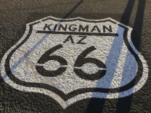
Route 66 is a 2,448-mile historic highway running from Chicago, Illinois to Santa Monica, California, crossing eight states. In 2026, its 100th anniversary year, you can drive it year-round, with spring (April to May) and autumn (September to October) being the best seasons. A highlights-only Route 66 road trip takes about 6 days with some flights, and a full drive takes 2 to 3 weeks. The road itself is free, and you pay only for car rental, fuel, hotels and attractions like Petrified Forest National Park.
Some roads get you from A to B. Route 66 gets you a story. Whether you’re a tourist chasing neon signs and milkshakes or a business traveler adding a few memorable days to a work trip, this guide covers the history, the best Route 66 tourist places, a six-day Route 66 itinerary, tickets, transport, tour operators, hotels and practical tips for 2026.
A Quick History of Route 66
Route 66 was commissioned in 1926 and quickly became the main road west. During the 1930s Dust Bowl, thousands of families used it to travel to California, and it earned the nickname “Main Street of America.” After World War II, road trips boomed and diners, motels and roadside attractions sprang up along the way. Interstate highways bypassed the route, and it was officially decommissioned in 1985. Today, preservation groups and the U.S. National Park Service help keep its landmarks alive, and 2026 marks the centennial with events across all eight states.
Route 66 Tourist Places and Features
1. Famous Tourist Places Along Route 66
1. Chicago, Illinois: The Historic Starting Point of Route 66
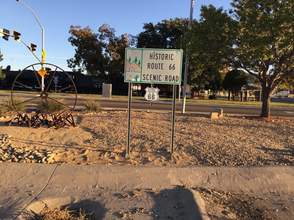
Chicago, Illinois is the official starting point of Route 66. When the highway was commissioned in 1926, Chicago became the eastern end of the “Mother Road,” linking the Great Lakes to the Pacific coast. The road was designed to connect many small towns with Chicago, which made it a route for trade, travel and new beginnings.
Historical Background
- 1926: Route 66 is officially established, with Chicago as its starting city. Highway signs went up in the following year.
- Original start: The route began in downtown Chicago near Michigan Avenue and Jackson Boulevard. Traffic ran westbound on Jackson and eastbound on Adams Street, which is why the “Begin” sign stands on East Adams Street today.
- 1930s: During the Dust Bowl and the Great Depression, many families traveled west on Route 66 in search of work, and the road became part of American folklore.
- After World War II: Car travel boomed. Families, soldiers and vacationers set out from Chicago, and roadside diners, motels and gas stations multiplied along the route.
- 1985: Route 66 was officially decommissioned as interstate highways replaced it, but Illinois preserved many original stretches and landmarks.
- 2026: The centennial year brings anniversary events, exhibits and travelers from around the world to the starting line in Chicago.
Historic Places to See Near the Start
- “Begin Route 66” sign (East Adams Street): The classic photo stop for every road trip, close to Michigan Avenue and the Art Institute of Chicago.
- Art Institute of Chicago: A world-famous museum founded in the 1800s, located right beside the starting point.
- Millennium Park: A modern public park opened in 2004, known for Cloud Gate (“The Bean”) and the Pritzker Pavilion.
- Lou Mitchell’s Restaurant: A long-running diner on West Jackson Boulevard, a traditional first breakfast stop for Route 66 travelers.
- Chicago Riverwalk: A scenic walk along the river with views of the city’s historic architecture.
Tip for tourists and business travelers: Visit the “Begin” sign early in the morning for a crowd-free photo, then have breakfast before you hit the road. Downtown Chicago is a major business hub, so it is easy to add a Route 66 start to a work trip. Learn more on the National Park Service Route 66 page and the Illinois Office of Tourism.
2. Chain of Rocks Bridge, Missouri: The Historic Bridge with a Bend
The Chain of Rocks Bridge is one of the most recognizable landmarks on Route 66. It crosses the Mississippi River on the northern edge of St. Louis and links Missouri with Illinois. At roughly one mile long, with a sharp bend in the middle, it is one of the most unusual bridges on the Mother Road, and today it is open only to walkers and cyclists.
Historical Background
- 1929: The bridge opened as a privately built toll bridge over the Mississippi River. It was named after the “Chain of Rocks,” a rocky, hard-to-navigate stretch of the river nearby.
- The famous bend: The bridge has a noticeable angle of about 22 degrees near the middle. It is commonly explained as a design choice that placed the bridge piers on solid bedrock and helped river boats navigate safely.
- 1936: Route 66 was rerouted onto the bridge as part of a bypass around the St. Louis city center, which made the crossing a busy link for cross-country travelers.
- 1950s and 1960s: Growing traffic and the new interstate system made the narrow bridge outdated. A newer bridge carrying the interstate opened nearby, and Route 66 traffic moved away from the old crossing.
- 1968 to 1970: The bridge was closed to vehicle traffic and left unused for many years.
- 1999: After restoration efforts by local groups, the bridge reopened as a pedestrian and bicycle crossing and became part of the regional trail network.
- 2026: During the Route 66 centennial year, the bridge remains a popular photo and walking stop for visitors from around the world.
Historic Sights Near the Bridge
- The bend in the bridge: The best spot for a photo and the feature most visitors come to see.
- Historic water intake towers: Castle-like stone towers in the river near the bridge that are part of the city’s early water system.
- Mississippi River views: Wide river scenery and a view of the St. Louis area from the middle of the span.
- Nearby Route 66 stops: Classic diners, a historic route marker and other roadside landmarks on both sides of the river.
Tip for tourists and business travelers: The bridge is close to downtown St. Louis, so it fits easily into a free afternoon between meetings. Go in the late afternoon for softer light, wear comfortable shoes, and bring water in warm months. Check access hours and conditions before you go. Learn more on the National Park Service Route 66 page, Visit Missouri and Explore St. Louis.
3. Blue Whale of Catoosa, Oklahoma: The Smiling Roadside Icon
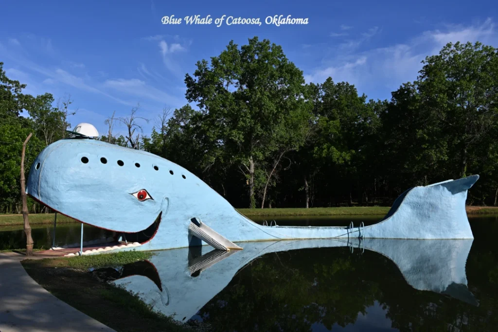
The Blue Whale of Catoosa is one of the most loved landmarks on Route 66. This smiling, 80-foot-long concrete whale rests in a quiet pond in Catoosa, just outside Tulsa, Oklahoma. It began as a family gift and grew into a classic roadside attraction that has welcomed generations of Route 66 travelers.
Historical Background
- Late 1960s to early 1970s: Local resident Hugh Davis built the whale by hand as an anniversary surprise for his wife, Zelta, who loved collecting whale figurines. Most sources place the work at around 1970 to 1972.
- A family swimming hole: The Davis family opened the pond to the public. Local families swam, sunbathed and slid off the whale’s tail, and the spot became a popular summer stop for travelers on Route 66.
- Late 1980s: The pond was closed to swimming, and the whale slowly fell into disrepair. Hugh Davis passed away in 1990.
- 1990s restoration: Local volunteers, community groups and Route 66 supporters repaired and repainted the whale in its bright blue color, and the site reopened for visitors to enjoy.
- Today: The whale is a protected piece of Route 66 heritage and one of the most photographed stops in Oklahoma. Swimming is no longer allowed, but visitors can walk around the pond, take photos and relax at the picnic areas.
- 2026: During the Route 66 centennial year, the Blue Whale remains a favorite family stop, and busy weekends and event days can bring larger crowds.
Why It Matters in Route 66 History
The Blue Whale shows the playful spirit of mid-century roadside America, when attractions were built to make drivers pull over. Its story, a personal gift that became a community landmark, is the kind of local story that makes Route 66 tourist places so memorable.
Historic Sights Near the Whale
- The whale and pond: The main photo spot, with its friendly smile and open mouth.
- Picnic and gift shop area: Shaded tables and small souvenir stops near the site, though on-site food is limited.
- Old Route 66 roadway: A preserved stretch of the original highway running through Catoosa.
- Tulsa Route 66 landmarks: Neon signs, vintage diners and Art Deco buildings a short drive away, good for an evening stop.
Tip for tourists and business travelers: The site is free to visit and takes about 30 to 45 minutes. Because it is close to Tulsa, it works well as a quick stop before or after meetings. Stay on the paths, do not climb on or swim around the whale, and pack water and snacks. Learn more on the National Park Service Route 66 page and Travel Oklahoma.
4. Cadillac Ranch, Texas: The Famous Art Installation You Can Paint
Cadillac Ranch is one of the most unusual landmarks on Route 66. Ten vintage Cadillacs stand buried nose-down in a flat Texas field just west of Amarillo, tilted at the same angle and covered in layers of spray paint. It began as an art project and became a roadside tradition that welcomes every traveler to add a little color.
Historical Background
- 1974: Cadillac Ranch was created by Ant Farm, an art and architecture collective from San Francisco made up of Chip Lord, Hudson Marquez and Doug Michels. It was funded by Stanley Marsh 3, a wealthy and eccentric Amarillo local who loved bold public art.
- The cars: The ten Cadillacs date from about 1949 to 1963. Together they show how the car’s famous tail fins grew and then shrank over those years, so the installation is also a timeline of American car design.
- The angle: The cars are commonly said to be buried at a slant that echoes the angle of the Great Pyramid of Giza, a joke about the “pyramids” of American car culture.
- The paint tradition: Visitors started spraying graffiti on the cars soon after they were installed, and the owner allowed it. The cars are repainted all the time, so no two visits look alike.
- 1997: The Cadillacs were dug up and moved about two miles west to a cattle pasture farther from the growing city. They were placed in the same pose and angle.
- Later years: The installation became one of the best-known roadside attractions in Texas. It sits beside Interstate 40, which now follows much of the old Route 66 path through the Panhandle.
- 2026: During the Route 66 centennial year, expect larger crowds, especially on weekends and at sunset.
Why It Matters in Route 66 History
Cadillac Ranch captures the playful, rebellious spirit of the American road trip. It honors the car that made Route 66 possible and invites visitors to become part of the artwork, which is why it is one of the most photographed Route 66 tourist places in Texas.
Historic Sights Near Cadillac Ranch
- The ten Cadillacs: The main attraction, best seen at sunrise or sunset when the colors glow.
- Amarillo Route 66 Historic District: A stretch of Sixth Avenue with antique shops, vintage signs, cafes and restored buildings from the highway’s heyday.
- The Big Texan Steak Ranch: A famous Route 66 restaurant known for its giant steak challenge. Check current hours and menu on its website.
- Slug Bug Ranch: A smaller, quirky roadside art stop with buried Volkswagen Beetles, a short drive east of Amarillo.
Tip for tourists and business travelers: The site is free, open-air and takes about 30 to 60 minutes. Wear closed shoes because the field can be muddy, and pack water, since there is little shade or food on site. If you paint, take your empty cans with you and respect other visitors. Amarillo works well as an overnight stop before or after meetings. Learn more on the National Park Service Route 66 page, Travel Texas and Visit Amarillo.
5. Petrified Forest National Park, Arizona: Ancient Wood and Painted Desert
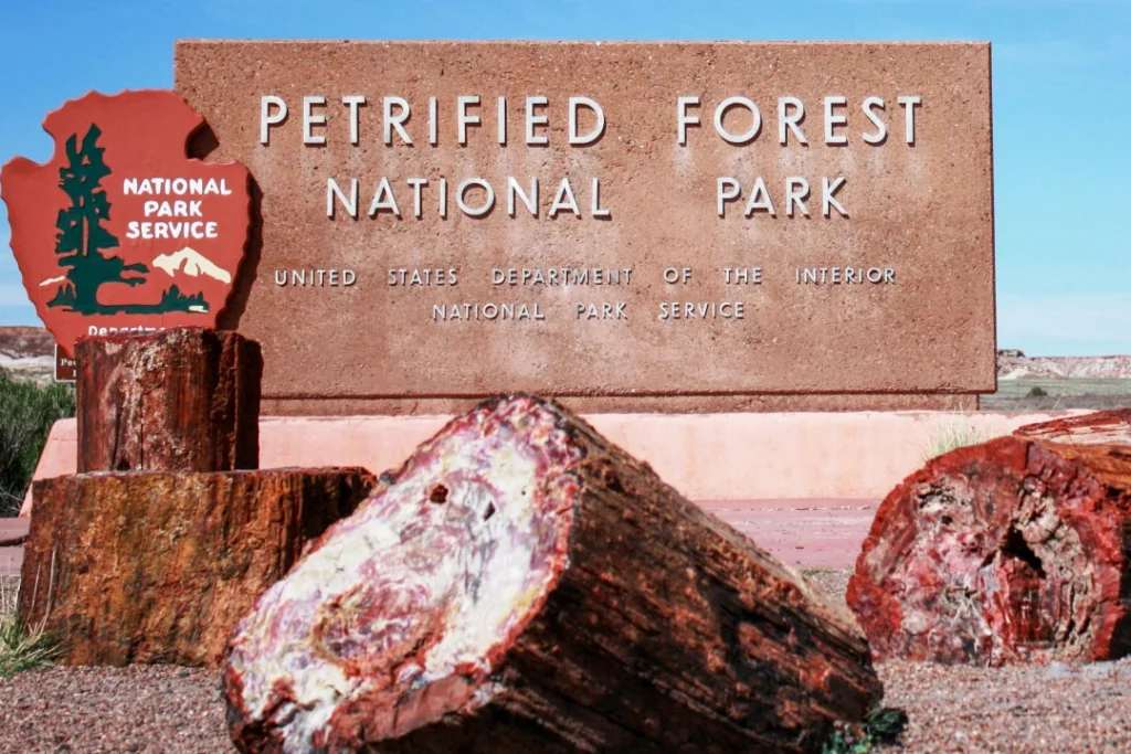
Petrified Forest National Park in northeastern Arizona is one of the most scenic stops on Route 66. It protects some of the world’s largest collections of colorful petrified wood, the rolling badlands of the Painted Desert and thousands of years of human history. It is also the only national park that contains a preserved section of the original Route 66 alignment.
Historical Background
- About 200+ million years ago: In the Late Triassic period, this region was a warm, wet floodplain with giant trees. Fallen logs were buried by sediment and slowly replaced by minerals, turning them into colorful stone.
- Ancient peoples: Ancestral Puebloan communities lived here for centuries. Sites such as Puerco Pueblo, Agate House (built partly from petrified wood) and the petroglyphs at Newspaper Rock still show how they lived.
- 1850s: U.S. Army survey expeditions exploring a western railroad and wagon route recorded the petrified wood, bringing it to wider attention.
- 1880s: The railroad arrived nearby, and visitors, collectors and businesses began removing large amounts of petrified wood, which alarmed local residents and scientists.
- 1906: President Theodore Roosevelt declared the area a national monument to protect it, one of the early uses of the Antiquities Act.
- 1920s to 1930s: The Painted Desert Inn began as a roadside stop in the 1920s. The National Park Service later took it over, and Civilian Conservation Corps workers and architect Mary Colter helped transform it into the Pueblo-style building visitors see today. It is now a National Historic Landmark.
- Route 66 in the park: Route 66 passed through this area, bringing tourists, truckers and families on their way to California. A vintage Studebaker car along the preserved roadway marks the old highway’s path.
- 1962: The monument was upgraded to a national park, and later boundary expansions protected more of the landscape.
- 1960s to 1980s: Interstate 40 replaced Route 66 as the main road, and the old highway was officially decommissioned in 1985. The preserved section inside the park remains a quiet reminder of the era.
- 2026: In the Route 66 centennial year, the park is a popular stop for road trippers, and busy weekends can bring larger crowds.
Why It Matters in Route 66 History
Petrified Forest National Park links two stories: deep time and the golden age of the American road trip. Travelers on Route 66 stopped here to see “stone trees” long before the interstate era, and it remains one of the best Route 66 tourist places for families, photographers and history lovers.
Historic Sights Inside and Near the Park
- Painted Desert Inn: A historic adobe-style building with Mary Colter’s design touches and wide desert views.
- Route 66 alignment and Studebaker marker: A short, popular photo stop along the old roadway.
- Newspaper Rock and Puerco Pueblo: Ancient rock carvings and a former village site.
- Blue Mesa, Crystal Forest and Giant Logs: Trails and viewpoints for seeing the petrified wood up close.
- Holbrook and the Wigwam Motel: A nearby Route 66 town known for its classic teepee-style rooms, a good overnight stop.
Tip for tourists and business travelers: Allow 2 to 4 hours for the main park road, which connects the north and south entrances. Pay the entrance fee or show a national park pass, carry plenty of water and a packed lunch, and wear sun protection. Never remove petrified wood, since taking it is illegal and harms the park. Flagstaff and Albuquerque are the nearest large hubs for meetings. Check fees, hours and road conditions on the Petrified Forest National Park (NPS), the NPS Route 66 page and Arizona Office of Tourism.
6. Seligman, Arizona: The Birthplace of the Route 66 Preservation Movement
Seligman, Arizona is a small desert town in the high plains of northern Arizona and one of the most important places in Route 66 history. When the interstate bypassed the town, local residents refused to let the old highway be forgotten. Their campaign helped spark the preservation movement that now protects Route 66 across all eight states.
Historical Background
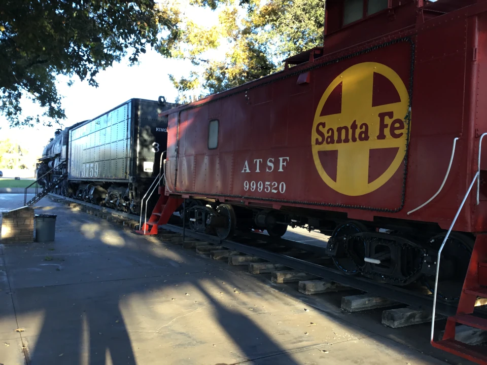
- 1880s: Seligman grew up as a railroad town when the Atlantic and Pacific Railroad, later part of the Santa Fe line, reached the area. It is named after Jesse Seligman, a banker who helped finance the railroad. The railroad made the town a busy stop for workers and travelers.
- 1926: Route 66 was commissioned and ran straight through Seligman’s main street. Gas stations, cafes, motels and shops opened to serve drivers heading west to California.
- Mid-century heyday: After World War II, thousands of cars passed through town each day, and local families built businesses around the highway. One example is the Snow Cap Drive-In, opened in the early 1950s by Juan Delgadillo and famous for its jokes and playful tricks on customers.
- Late 1970s: Interstate 40 bypassed Seligman. Traffic dropped almost overnight, many businesses closed, and the town faced an uncertain future.
- 1987: Local barber Angel Delgadillo, Juan’s brother, and other residents formed the Historic Route 66 Association of Arizona. Their efforts led Arizona to designate its stretch of the old road as a state historic highway, widely described as the first in the country.
- Spreading the idea: The Arizona effort inspired similar associations in other states and growing international interest in the “Mother Road.” Seligman became a favorite stop for road trippers from around the world.
- Pop culture: Seligman is often cited as one of the real-life inspirations behind the fictional town in Pixar’s Cars, which brought it a new generation of visitors.
- 2026: In the Route 66 centennial year, the town welcomes visitors with vintage signs, classic cars and events, and weekends can be busy.
Why It Matters in Route 66 History
Seligman proves that a small community can save a piece of history. Without the effort that began here, many Route 66 tourist places might have disappeared. Today the town is a living museum of the road, run by families who still keep its stories alive.
Historic Sights in Seligman
- Angel and Vilma Delgadillo’s Route 66 Gift Shop and Visitor Center: The former barber shop, now a gift shop and informal museum with Route 66 memorabilia and signed visitor notes.
- Delgadillo’s Snow Cap Drive-In: A colorful, humorous roadside diner built with scrap materials, known for burgers, shakes and playful menu jokes.
- Main Street (old Route 66): A walkable strip of vintage neon signs, classic cars, quirky shops and cafes.
- Nearby Grand Canyon Caverns and Peach Springs: Further stops along a long, scenic preserved stretch of Route 66 west of Seligman.
Tip for tourists and business travelers: Seligman is small, so allow 1 to 2 hours for a walk, a meal and souvenirs. Fill your fuel tank beforehand, carry water, and expect limited mobile signal on the stretch to the west. Many businesses are family-run and may keep seasonal or shorter hours, so check before you go. Flagstaff is the nearest larger hub for overnight stays and meetings. Learn more on the National Park Service Route 66 page, the Arizona Office of Tourism and the Historic Route 66 Association of Arizona.
7. Santa Monica Pier, California: The End of the Trail
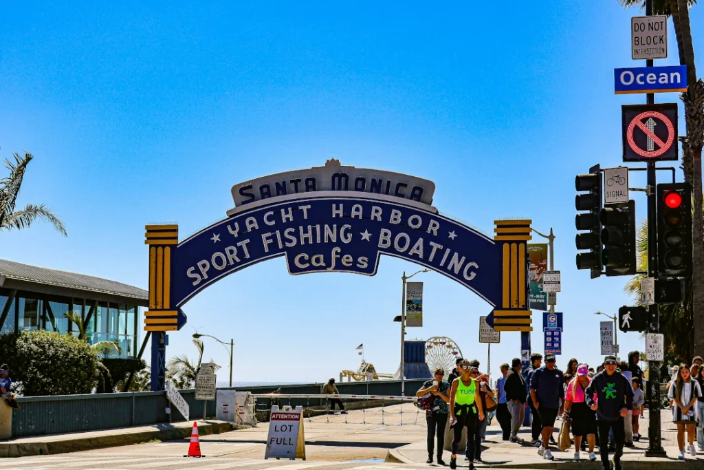
The Santa Monica Pier is the traditional finish line of Route 66. Standing on the Pacific coast in Los Angeles County, it has a Ferris wheel, an old-fashioned carousel and wide ocean views, which make it a popular place to end a cross-country road trip at sunset. It is also more than a century old, with a history of its own.
Historical Background
- 1909: The Municipal Pier opened in September 1909. It was built mainly to carry a sewer pipe, and it also gave the growing seaside city a public promenade and fishing spot.
- 1916: The neighboring Looff Pier opened as an amusement pier, built by carousel maker Charles Looff. It included the Looff Hippodrome building, which houses a historic carousel and is a National Historic Landmark.
- 1920s to 1940s: The pier became a popular entertainment area with a ballroom, games, fishing and rides, and the Santa Monica sign arch at the pier entrance was added in the early 1940s.
- 1936: Route 66 was extended to Santa Monica. Before that, the highway ended in downtown Los Angeles. The extension is why Santa Monica is linked with the “end of the trail” story, even though the pier itself is a symbolic rather than an official endpoint.
- Mid-century road trip era: Families driving west on Route 66 reached the Pacific here, and the pier became a classic last stop for California-bound travelers.
- 1970s and 1980s: The pier faced demolition proposals and then storm damage in the early 1980s. Residents campaigned to save it, and the community’s efforts led to major repairs and a new chapter as a public landmark.
- 1990s: Pacific Park, an amusement park with a Ferris wheel and roller coaster, opened on the pier. Its Ferris wheel is widely described as the world’s first solar-powered one.
- 2009: An “End of the Trail” sign was dedicated at the pier entrance to mark the traditional western end of Route 66, giving travelers an official photo spot.
- 2026: In the Route 66 centennial year, the pier is expected to welcome road trippers from around the world, so busy weekends and sunset hours can be crowded.
Why It Matters in Route 66 History
For many travelers, reaching the Pacific Ocean is the emotional end of a Route 66 road trip. The pier turns a long journey from the Midwest into a finish with a view, and it remains one of the most photographed Route 66 tourist places in California.
Historic Sights at and Near the Pier
- “End of the Trail” sign: The classic finish-line photo for Route 66 travelers.
- Pacific Park and the Ferris wheel: Rides and sea views, especially beautiful at sunset.
- Looff Hippodrome Carousel: A historic carousel building from the early days of the amusement pier.
- Santa Monica Pier Aquarium: A small, family-friendly marine education center beneath the pier.
- Third Street Promenade and the beach: A walkable shopping street, cafes and a wide sandy beach nearby.
Tip for tourists and business travelers: Entry to the pier is free, and rides at Pacific Park are paid per ride or with a wristband. Allow 2 to 3 hours, arrive about an hour before sunset and use public transport or ride-hailing, since parking can be expensive and busy. Santa Monica is a strong base for meetings and conferences, and Los Angeles International Airport (LAX) is nearby. Learn more on the official Santa Monica Pier website, National Park Service Route 66 page and Visit California.
8. Route 66 and Joshua Tree: A Desert Side Trip
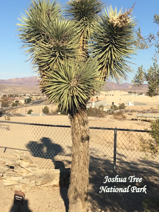
Joshua Tree National Park is a popular desert add-on for travelers finishing a Route 66 road trip in California. The park is not on Route 66 itself, but it lies within reach of the Mojave Desert stretch of the highway near Needles, Amboy and Barstow, and it makes a scenic stop on the way to the Los Angeles area or Palm Springs.
Historical Background
- Early peoples: Native communities, including the Serrano, Cahuilla and Chemehuevi, lived in and traveled through this desert for centuries.
- The name: The Joshua tree is commonly said to have been named by 19th-century Mormon settlers, who saw its outstretched branches as a biblical figure raising arms in prayer.
- Ranching and mining: Homesteaders, cattle ranchers and miners worked the area in the late 1800s and early 1900s. Sites such as Keys Ranch preserve this history.
- 1936: The area was protected as Joshua Tree National Monument.
- 1994: It became a national park under the California Desert Protection Act, and its size was expanded.
- Link to Route 66: During the mid-century road-trip boom, travelers crossing the Mojave on Route 66 helped popularize desert tourism across Southern California.
- 2026: In the Route 66 centennial year, many road trippers pair the highway’s final desert miles with a day at Joshua Tree.
Top Things to See
- Hidden Valley and Skull Rock: Easy walks among giant boulders, good for families.
- Keys View: A high viewpoint over the Coachella Valley.
- Cholla Cactus Garden: A dense field of cholla cactus, best at sunrise or sunset.
- Stargazing: The park is known for dark night skies.
How to Fit It into Your Route 66 Trip
- Itinerary option: On Day 6, instead of driving straight to Santa Monica, add an extra night near the park or in Palm Springs, then continue to Los Angeles the next day.
- Getting there: Drive from the Barstow or Needles area, or fly into Palm Springs International Airport (PSP) and rent a car.
- Tickets: The park charges an entrance fee or accepts a national park pass. Fees, including any rules for international visitors, change, so confirm on the official NPS page.
- Food: Very limited inside the park. Bring water, snacks and a packed lunch, and fill your fuel tank in nearby towns.
- Safety: Summer temperatures can be extreme, so visit in spring or autumn and carry plenty of water. Mobile signal is weak, so download offline maps.
Tip for tourists and business travelers: Palm Springs is a convenient base for meetings and conferences, so Joshua Tree works well as a one-day “bleisure” escape. Plan official details with the Joshua Tree National Park (NPS), NPS Route 66 page and Visit California.
9. Camp Clipper Desert Training Center, California
Historical Background
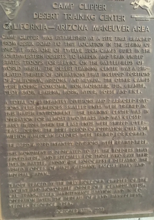
In early 1942 the United States was preparing to send troops into the deserts of North Africa, and the Army had nowhere to practice that kind of fighting. The solution was the Desert Training Center (DTC), set up in March 1942 under Major General George S. Patton Jr.
The center covered roughly 18,000 square miles of southern California, western Arizona and a corner of southern Nevada. It was the largest military training ground ever established in the United States. Its headquarters, Camp Young, sat near what is now Chiriaco Summit, east of Indio, California.
Why the desert?
The terrain and climate were very close to what troops would meet overseas. Summer temperatures often passed 110°F, water was scarce, and soldiers had to learn to keep tanks, trucks and themselves working in dust, heat and open ground. Patton pushed hard on the practical side, covering:
- Armored and mechanized warfare
- Navigation across featureless terrain
- Water discipline and heat survival
- Vehicle maintenance and logistics in harsh conditions
From DTC to C-AMA
Patton left in the summer of 1942 to lead the Western Task Force in the invasion of North Africa. Later commanders included Alexander Patch and Walton Walker. In late 1943 the site was renamed the California-Arizona Maneuver Area (C-AMA), and its focus widened to preparing units for operations in other theaters as well. The training area was shut down in 1944. About a million soldiers had passed through it, and many later fought in North Africa, Europe and the Pacific.
What remains today
Time has erased much of the camps, but not all of it. Visitors can still find:
- Rock-outlined unit insignia and foundations at former camp sites
- Faint tank and vehicle tracks that have lasted for decades in the desert floor
- Remains of camps such as Iron Mountain, Granite and Coxcomb, now in remote areas
- The General Patton Memorial Museum at Chiriaco Summit, just off Interstate 10, with exhibits, vehicles and artifacts
Visiting the Area
The museum is the easiest starting point, since it’s right by the interstate and open to the public. The remote camp sites are another matter. Many sit on rough desert tracks, so plan for:
- Season: October to April, as summers are dangerously hot
- Water and fuel: carry more than you think you’ll need
- Vehicle: a high-clearance vehicle for backcountry roads
- Land rules: some areas are protected, so stay on marked routes and don’t remove artifacts
2. Main Features of Route 66
- Eight states: Illinois, Missouri, Kansas, Oklahoma, Texas, New Mexico, Arizona and California.
- Vintage diners, neon signs, trading posts, themed motels and roadside art.
- Landscapes that change from Midwest farmland to Great Plains, red-rock desert and Pacific coast.
- Many sections are original pavement. Others merge with modern interstates, so a map or GPS route guide helps.
3. Best Experiences for Tourists
- Renting a classic convertible or a motorcycle for part of the drive.
- Sleeping in a themed motel, such as a teepee-style room.
- Eating at a retro diner and trying a local milkshake or burger.
- Collecting passport stamps and photos at the famous landmarks above.
- Joining a 2026 centennial event or festival in a Route 66 town.
6-Day Historic Route66 Itinerary (Highlights Plan)
Note: The full Route 66 is about 2,448 miles, so this six-day plan combines driving with a short flight to hit the main highlights. For a relaxed, all-driving trip, allow 2 to 3 weeks. Drive times are estimates, so check live conditions before each leg.
Day 1: Chicago, Illinois
Arrive at Chicago O’Hare (ORD) or Midway (MDW), pick up your rental car and visit the Historic Route66 “Begin” sign. Spend the afternoon in Millennium Park and along the Chicago Riverwalk, then enjoy a deep-dish dinner.
Day 2: Chicago to St. Louis, Missouri
Drive about 5 to 6 hours with stops in small Illinois Historic Route66 towns. In the late afternoon, walk or cycle across the Chain of Rocks Bridge, then see the Gateway Arch at sunset.
Day 3: St. Louis to Tulsa, Oklahoma
Drive through the Ozarks and the corner of Kansas, with plenty of retro roadside stops. Finish at the Blue Whale of Catoosa just outside Tulsa and stay overnight in Tulsa.
Day 4: Tulsa to Amarillo, Texas
Cross Oklahoma, stopping at diners and old gas stations. Reach Amarillo by late afternoon for Cadillac Ranch at golden hour, and bring a spray can if you’d like to leave your mark.
Day 5: Fly to Arizona, Petrified Forest and Seligman
To save time, take a flight from Amarillo (AMA) or Albuquerque (ABQ) toward Phoenix (PHX) or Flagstaff (FLG), then pick up a new rental. Visit Petrified Forest National Park and drive a segment of Historic Route66 through the park. Overnight in Holbrook or Flagstaff.
Day 6: Seligman to Santa Monica, California
Spend the morning in Seligman, then continue west through the Mojave Desert toward Los Angeles. Allow plenty of time, since the drive from Seligman to Santa Monica is long. Alternatively, fly Las Vegas (LAS) to Los Angeles (LAX). Finish at Santa Monica Pier for the classic sunset photo.
Tickets and Tour Plans for Historic Route66
There is no ticket for the highway itself, but several stops charge fees. Prices change, so always confirm on the official website before you go.
| Place | Ticket / Cost | Notes |
|---|---|---|
| Chicago “Begin” sign | Free | Public street photo spot |
| Chain of Rocks Bridge | Free | Pedestrians and cyclists only |
| Blue Whale of Catoosa | Free | Roadside attraction |
| Cadillac Ranch | Free | Open-access field, bring your own spray paint |
| Petrified Forest National Park | Per-vehicle entrance fee | National park passes may apply, check NPS |
| Seligman | Free to walk | Pay for food and souvenirs |
| Santa Monica Pier | Free entry | Pay per ride or wristband at Pacific Park |
Available Tour Plans
- Self-drive: Rent a car and follow a Historic Route66 map. This is the most flexible and budget-friendly option.
- Guided motorcycle tours: Group rides with support vehicles, ideal for riders.
- Escorted or small-group tours: Set itineraries with hotels and sightseeing handled for you.
- Segment trips: Choose one state or section, such as Arizona or Oklahoma, for a short getaway or a weekend added to a business trip.
Air Tickets and Booking
Book flights directly on airline websites, such as American Airlines and United Airlines. Check airport information at Chicago Airports (O’Hare and Midway) and Los Angeles International Airport (LAX). A one-way plan (fly into Chicago, fly out of Los Angeles) works best for a Historic Route66 trip, but one-way car rentals often carry a drop-off fee, so compare prices early.
Local Transport on Historic Route66
- Rental car: The best option for the open road. A valid driver’s license is required, and visitors from some countries may need an International Driving Permit. Check with the rental company.
- Motorcycle or RV rental: Popular for a classic Historic Route66 road trip. Check fuel range between towns in desert areas.
- City transit and ride-hailing: Useful in Chicago, St. Louis, Tulsa, Albuquerque and Los Angeles.
- Domestic flights: A good way to skip long stretches and save days.
Two Historic Historic Route66 Tour Operators to Consider
- EagleRider: Well known for motorcycle rentals and guided Historic Route66 rides, including support options for groups.
- Road Scholar: A educational-travel organization that has offered small-group, guided programs covering American road routes. Check its site for current Route 66 departures.
Tour availability, pricing and itineraries change by season. Confirm directly with each operator before you book.
Two Preferred Hotels for Your Stay
- Hotel Monte Vista, Flagstaff, Arizona: A historic 1920s hotel in downtown Flagstaff with a classic Historic Route 66 feel, good for tourists and business travelers alike.
Contact Detail: +1 3105767777, 928-779-6971 |
⭐ 4.0 ( 1,317 Google reviews)
2. Fairmont Miramar Hotel & Bungalows, Santa Monica, California: A polished, upscale stay near the pier, ideal for finishing the trip or hosting business meetings.
Contact Detail: (310) 392-6806
⭐ 4. 0 (679 total reviews)
Food Facilities at Historic Route66 Tourist Places
- Chicago: Everything from street food to fine dining within walking distance of the “Begin” sign.
- Chain of Rocks Bridge and Cadillac Ranch: Open-air sites with limited on-site food, so carry water and snacks.
- Blue Whale of Catoosa: Facilities are limited, with picnic spots nearby and restaurants in town.
- Petrified Forest National Park: Limited food service inside the park, so bring a packed lunch and plenty of water.
- Seligman: Classic diners and snack shops right on the main road.
- Santa Monica Pier: Many restaurants, snack stands and cafes right on the pier.
Checklist for Families Travelling with Infants
- Infant car seat that meets U.S. safety rules (reserve one with your rental or bring your own).
- Passport, birth certificate and any required visas or ESTA approvals for every family member, including the baby.
- Diapers, wipes, spare clothes and a changing mat. Plan stops every 1.5 to 2 hours.
- Formula, bottles, sterilizing supplies and baby food. Carry a small cooler for hot days.
- Sun hats, sunscreen approved for infants, window shades and a light blanket for air-conditioned cars.
- Infant medicines, a thermometer and a basic first-aid kit, plus your pediatrician’s contact details.
- Travel insurance with medical cover, and the address of the nearest hospital along each day’s route.
- Stroller or baby carrier, plus entertainment such as soft toys and music for long drives.
Travel Guidelines and Tips for Historic Route66
- Best time: April to May and September to October bring mild weather. Summers in Arizona and New Mexico can be extremely hot, and winter can bring snow in higher areas.
- Documents: International visitors should check visa and ESTA rules well in advance on official U.S. government sites.
- Driving: Americans drive on the right. Respect speed limits, and never use a phone while driving.
- Fuel and water: Fill up in larger towns before desert stretches.
- Navigation: Download offline maps, since mobile signal can drop in remote areas, and use a Historic Route66 guidebook or app.
- Business travelers: Base yourself in major cities for meetings, then add a Historic Route66 day trip. Keep receipts for expense claims, and book flexible fares.
- Book early: 2026 is the centennial, so hotels and rentals in popular towns may fill up fast.
- Safety and respect: Do not climb on private property. Leave no trash, especially at Cadillac Ranch.
Official and Authentic Links for Historic Route66 Planning
Historic Route66 and National Parks
- U.S. National Park Service: Historic Route66
- Petrified Forest National Park (NPS)
- Route 66 Centennial
- Santa Monica Pier
State Tourism Boards
- Illinois Office of Tourism
- Visit Missouri
- Travel Kansas
- Travel Oklahoma
- Travel Texas
- New Mexico Tourism
- Arizona Office of Tourism
- Visit California
Government Travel, Visa and Security
- U.S. Department of State: Travel and Visas
- ESTA (U.S. Customs and Border Protection)
- Transportation Security Administration (TSA)
Historic Route66 FAQ: Frequently Asked Questions
1. How long is Historic Route66, and which states does it cross?
Historic Route66 is about 2,448 miles long and passes through Illinois, Missouri, Kansas, Oklahoma, Texas, New Mexico, Arizona and California.
2. What is the best time to visit Historic Route66 in 2026?
Spring (April to May) and autumn (September to October) offer the most comfortable weather. Summer is very hot in the desert states, and winter can bring snow in some areas. Centennial events in 2026 may draw extra crowds, so book early.
3. Can I complete Historic Route66 in six days?
Only as a highlights trip that mixes driving with flights. A full drive usually takes 2 to 3 weeks if you want to enjoy the stops.
4. Do I need tickets to travel on Historic Route66?
No. The road is free. You only pay for attractions with entry fees, such as Petrified Forest National Park, plus rides at Pacific Park on Santa Monica Pier. Check official sites for current prices.
5. Is Historic Route66 suitable for business travelers?
Yes. Major cities on the route, including Chicago, St. Louis, Tulsa, Albuquerque and Los Angeles, are strong business hubs. Many professionals add a “bleisure” weekend to a work trip by exploring a short Historic Route66 section.
6. Do international visitors need a visa or ESTA?
Most international visitors need a visa or an approved ESTA, depending on nationality. Always confirm requirements on the official U.S. Department of State and CBP websites before booking.
7. Where can I find official Historic Route66 information?
Start with the National Park Service Historic Route66 page, the Historic Route66 Centennial website and the tourism boards of each state listed above.
Explore More Travel Guides on our Ryde Travel Web Site
USA Visa Types & Requirements: Complete 2026 Guide
America Best Lakes: 5 Stunning Lakes Must Visit in 2026
Best Cities to Visit in America: Top 10 Places for 2026
Final Thoughts
Historic Route66 is more than a line on a map. It is a 2,448-mile story of Dust Bowl families, post-war holidays, roadside dreamers and small towns that refused to disappear. From the “Begin” sign in Chicago to the Pacific at Santa Monica Pier, every stop adds a different chapter, whether it is the playful Blue Whale of Catoosa, the painted Cadillacs outside Amarillo or the petrified wood of Arizona.
The quieter stops matter too. The Mojave Desert stretch near the old Desert Training Center reminds us that this highway has always been tied to bigger moments in American history. Long before Route 66 became a tourist trail, General Patton trained more than a million soldiers in the same desert, and traces of that effort can still be found today. Adding the General Patton Memorial Museum or Joshua Tree National Park gives your final days a slower, more reflective pace after the busy miles in the Midwest.
2026 is a special year to go, with the centennial bringing events, exhibits and extra energy to every state along the route. That also means busier roads and fuller hotels, so plan early:
- Choose your season: April to June or September to October for comfortable weather, and avoid the desert in summer.
- Book key stays and your rental car early, especially in Flagstaff, Williams and Santa Monica, and compare one-way drop-off fees.
- Prepare for the desert: carry extra water, fill your fuel tank in larger towns and download offline maps.
- Check official sources for ticket prices, opening hours, road conditions and visa rules, such as the National Park Service Route 66 page.
- Travel respectfully: leave no trash, never take petrified wood or desert artifacts, and support the family-run diners and motels that keep the road alive.
Whether you drive the full route over two to three weeks or take the six-day highlights plan, Route 66 rewards travelers who slow down. Pack your curiosity, plan your stops and enjoy the open road. For more ideas, explore our best cities to visit in America and USA visa guide before you go.





Leave a Reply