This guide contains affiliate links. We may earn a commission at no extra cost to you — see our Affiliate Disclosure and Affiliate Disclosure Policy for details.
Table of Contents
Introduction to Mount Longonot
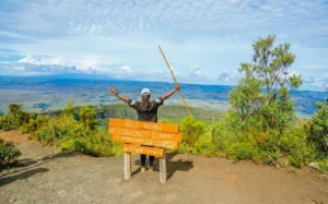
Do you dream about hiking on one of Kenya’s dormant mountains? Here is the deal. Mt Longonot is one of them. It reaches an elevation of about 2,776 m at the summit, while the main entrance gate sits around 2,150 m. The mountain, arguably one of the most popular hiking destinations, is located about 90 km from Nairobi in Naivasha sub-county, southeast of Lake Naivasha in the Great Rift Valley. Your drive to the park takes roughly 1.5 to 2 hours on the main road from Nairobi to Naivasha. The surrounding national park, which is managed by the Kenya Wildlife Service, covers an area of 52 square kilometres. You should check current notices on the official Kenya Wildlife Service website before travelling to verify trail conditions.
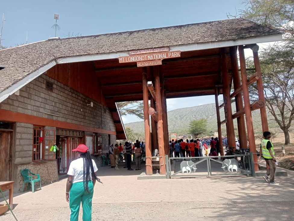
A Mount Longonot hike is the classic Rift Valley adventure for people who live in Nairobi or are visiting it. You get a proper volcano, a forested crater, big wildlife country and a lake view, all within a morning’s drive of the capital. This Mount Longonot hiking guide pulls together everything you need for 2026: fees, transport, the route, difficulty, where to stay, what it costs and who to call. It is built around the real Mount Longonot hike experience of a regular hiker, plus our own checks against official sources.
Whether you are planning a Mount Longonot day trip from Nairobi or a weekend around Lake Naivasha, Mount Longonot National Park Kenya is one of the most rewarding short hikes in East Africa.
Why Hike Mount Longonot
Mt Longonot is a dormant stratovolcano rising above the floor of the Great Rift Valley. The name originates from the Maasai word Oloonong’ot, which means “mountains of many spurs”.
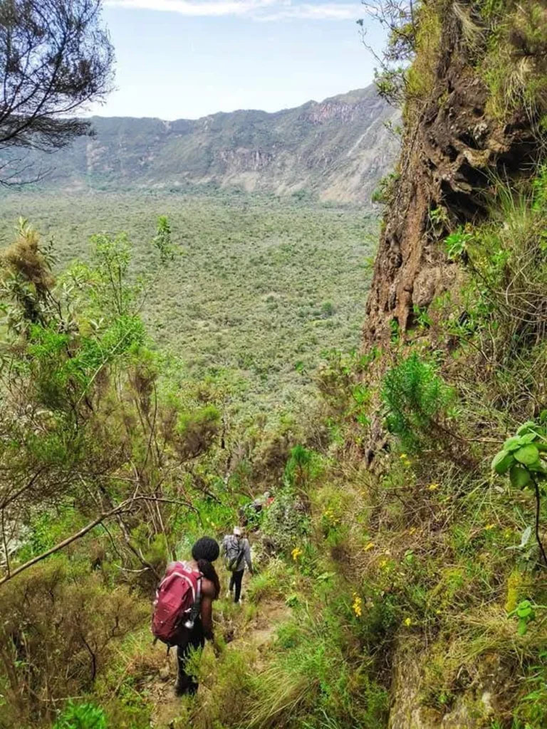
A primary highlight of your hike up Mt Longonot is reaching the massive volcanic crater at the top. From the rim, you can enjoy sweeping views across the Great Rift Valley and Lake Naivasha.
Wild animals inhabit the slopes and surrounding park grounds. Wildlife you might see on the mountain includes buffalo, zebra, giraffe, and antelope.
Beyond the views, hiking Mount Longonot is popular for three simple reasons:
- It is close. You can leave Nairobi at dawn and be back for dinner.
- It is a real challenge without being technical. The path is well-defined, so no climbing gear or mountaineering experience is needed, just decent fitness.
- It is varied. In a single day you pass through open grassland, steep eroded ridges, a crater rim and, if you walk the full loop, a view straight down into a hidden forest.
Mount Longonot Volcano History and Geology
Longonot is a young volcano by geological standards. It is a stratovolcano built up over hundreds of thousands of years from alternating layers of trachytic lava and volcanic ash and rock fragments (pyroclastic deposits). Its large summit caldera formed when big eruptions emptied the magma chamber and the ground above collapsed. Older lava flows are still visible on the outer slopes, and the volcano sits within a wider geothermal field that includes the Olkaria area near Hell’s Gate.
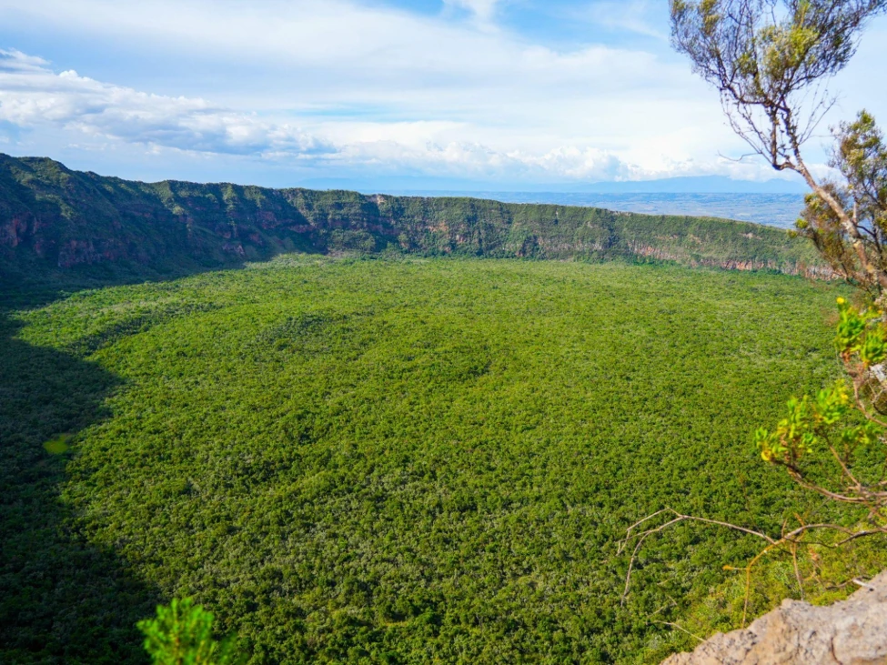
According to KWS, the volcano last erupted in 1863, and the area was gazetted as a national park in 1983 to protect its volcanic landscape. Inside the crater, a dense and secluded forest has developed, while the outside is cut by V-shaped valleys and rugged ridges, which is exactly what the Maasai name “mountain of many spurs” describes. Source: Kenya Wildlife Service (KWS) Mt Longonot page.
The mountain is considered dormant, not extinct. For hikers that simply means a quiet, forested crater today and a good geology lesson on the way up.
How to Get to Mount Longonot from Nairobi
You can reach Mt Longonot from Nairobi using two road transport options for a day excursion. However, if you want to get there faster, a chopper from Wilson Airport to take you to the gate is the best option. It costs about $ 2,000 to $2600 an hour. However, if you prefer getting there by road, here are your options.
Your first option is traveling by rental car or booking a car with a professional driver. Driving directly covers the 90 km distance in roughly 1.5 to 2 hours along the Nairobi to Naivasha road. Starting early from Nairobi gives you more time on the trail and allows for cooler hiking conditions.
Your second option is booking a day tour van from Nairobi that includes hotel pickup. These organized tours supply transport in a van, park entry, a ranger guide, and lunch. Many operators combine Mt Longonot with Hell’s Gate National Park or a Lake Naivasha boat ride. Day tours are listed at roughly USD 120 to 200 per person.
Budget option: public transport. Matatus run from Nairobi to Naivasha town in about 2 hours, typically costing roughly KES 300 to 500 one way. From Naivasha, a taxi, boda boda or local matatu takes around 45 minutes to the gate, with fares of roughly KES 200 to 500 depending on how you travel and whether you bargain. Agree the fare, and a pick-up time, before you set off, because transport back from the gate in the late afternoon is not guaranteed.
Other ways to reach the Naivasha area: the Madaraka Express (SGR) train runs to Naivasha Terminus, and light aircraft fly from Wilson Airport to the Naivasha airstrip. Both still need a road transfer to the Longonot gate.
Mount Longonot Entrance Fees and Opening Hours
Mt Longonot National Park opens daily from 6 am to 6 pm. Non-resident entry fees, in force since October 1, 2025, are USD 50 per adult and USD 25 per child.
Your entry payments must be made online in advance through KWS’s eCitizen system at kwspay.ecitizen.go.ke using a Visa card. Official Kenya Wildlife Service contacts are customerservice@kws.go.ke and the toll-free line 0800 597 000 in case you have a question.
For 2026, the KWS fee schedule for Mt Longonot National Park (per person, per day) is:
| Visitor category | Adult | Child |
|---|---|---|
| East African citizen | KES 500 | KES 250 |
| Kenya resident | KES 675 | KES 350 |
| Non-resident | USD 50 | USD 25 |
| African citizen (outside East Africa) | USD 20 | USD 10 |
Good to know: the park is cashless, so KWS payments go through KWSPay on eCitizen. Besides cards, KWS accepts M-Pesa and eCitizen Wallet, so you are not limited to a Visa card. Keep the QR-coded receipt on your phone and carry your ID or passport. Small children (5 and under) are generally exempt, and vehicles, guides and camping are charged separately. Fees can change, so always confirm on the Kenya Wildlife Service (KWS) Mt Longonot page before you pay.
Mount Longonot Crater Rim Hiking Trail
The trail on Mt Longonot covers about 6 km round trip from the entrance gate to the rim. Including the full rim circuit extends your walk to about 13 km. Completing the full loop takes roughly 4 to 6 hours with breaks. The terrain is dusty with loose gravel, and several sections are steep and eroded. The route presents a moderate to hard difficulty for hikers.
The walk starts at the park entrance gate, where you present your digital tickets. You then ascend through light vegetation along the lower slopes toward the volcanic crater. There’re designated resting points along the way to allow you to catch your breath.
Your climb becomes steep and eroded as the path approaches the crater rim. Be careful with the loose gravel during your final ascent. Reaching the rim reveals dramatic views into the volcanic crater and across the surrounding rift landscape.
You can choose to walk the full circuit around the rim of the volcano. The rim path features narrow, steep, and slippery sections. Kenya Wildlife Service has issued warnings about steep and slippery sections after a rescue from the crater.
Facilities near the gate include a basic shop and the Olongoonot campsite. There are no lodges inside the park boundaries.
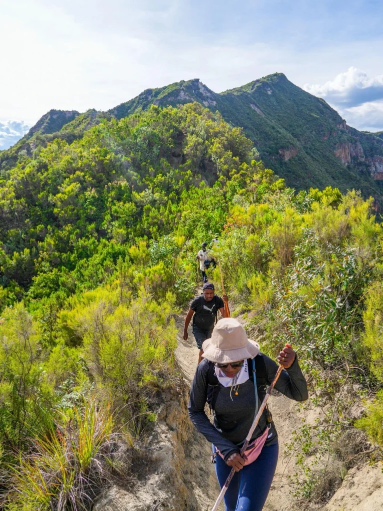
The Mount Longonot Crater Rim Trail is what makes this hike special. Most visitors turn around at the first rim viewpoint, which is a fine Mount Longonot crater hike in its own right. If you still have energy, the full rim circuit adds another 7 km or so and takes you to the true summit. The mountain has no roads, so every route is on foot.
Mount Longonot Hike Distance, Elevation and Difficulty
Here is how the Mount Longonot hike distance and duration break down, combining our guest writer’s figures with other published trail data (small differences between sources are normal):
| Detail | Figure |
|---|---|
| Gate to crater rim (round trip) | About 6 km (some sources say 6.2 km) |
| Full rim circuit, including the walk up and down | About 13 km (some sources say 13.5 km) |
| Rim loop only | About 7 km |
| Gate elevation | About 2,100 to 2,150 m |
| Summit elevation | About 2,776 m |
| Total ascent | Roughly 630 to 680 m, most of it in the first 3 km |
| Time to the rim | About 1.5 to 2 hours up |
| Full loop with breaks | About 4 to 6 hours |
| Difficulty | Moderate to hard |
Mount Longonot hike difficulty, honestly: the hardest part is the first steady climb from the gate to the rim, where the path is steep, dusty and loose underfoot. Altitude is modest, but the gate is already above 2,000 m, so some people notice a faster heartbeat, a headache or fatigue. There are no technical sections, which is why active beginners can manage it at a steady pace. If you have not hiked uphill for a while, go slowly, rest often and be ready to turn back at the rim.
Climbing Mount Longonot is realistic for most reasonably fit adults and teenagers. It is a poor choice for anyone with serious knee, heart or breathing problems, or for very small children.
Step-by-Step Mount Longonot Hiking Route and Trail Map
There is only one main path, so navigation is simple. This is how the day unfolds on the ground:
- Gate and trailhead. Show your KWSPay receipt and ID, fill your reusable water bottle (single-use plastic is banned) and decide on a ranger or guide. The trail starts behind the information centre, wide and flat at first, then turning steadily uphill.
- First climb (to about 2 km). The path gets steeper, with loose dust and gravel. Around 2 km in you reach a false peak, a good place to catch your breath and drink.
- Second climb. This is the steepest and most eroded stretch. Some short stairs help, but footing needs care, especially on the way down. The crater crest stays in view and pulls you on.
- The crater rim. You step onto the rim about 3 km from the gate and the crater opens below you. This is where many hikers turn back after photos and a snack.
- Optional rim circuit. The rim path is narrow and exposed in places. Walking counter-clockwise gets the harder climbs done early, and a bright orange sign marks the summit.
- Return. Complete the loop back to the point where you joined the rim, then retrace your steps down the same trail to the gate before it closes at 6 pm.
Trail map: there is a single out-and-back access path with a loop on top, so the route is easy to picture: gate, then straight uphill to the rim, then a loop around the crater, then back down the same way. For a downloadable GPS track, check a trail app such as Komoot or AllTrails, and always pick up a printed map or ask a ranger at the gate. Phone signal on the rim can be patchy.
Wildlife and Birdwatching Experience
The slopes of Mount Longonot National Park Kenya are real wildlife country. Commonly reported species include plains zebra, Maasai giraffe, buffalo, eland, hartebeest, Thomson’s gazelle, impala, warthog, baboon, vervet monkey and rock hyrax. KWS lists bushbuck among the park’s antelope, and leopards are present but rarely seen. Lions are mentioned in some park descriptions, though sightings on the trail are very unlikely.
Buffalo are the animals to respect. They can be unpredictable when startled. Give them plenty of room (KWS advises at least 20 m for wildlife viewing), never walk between a buffalo and its calf and use the ranger option if you are nervous. Do not feed any animal.
Birdwatching. The ridge is a good place to watch raptors riding the thermals. Look for Verreaux’s eagle, augur buzzard, black-shouldered kite and African hawk-eagle. Bring binoculars if you are keen, since the rim gives you eye-level views of birds soaring over the crater.
What to Pack and Essential Safety Tips
Packing appropriate items helps maintain your comfort and energy on the trail.
- Water for hydration during your hike
- Sun protection including sunscreen and lip balm
- Sturdy hiking shoes with good traction
- A comfortable hat to shield your head from the sun
- A light jacket for protection against wind
- Energy-rich snacks to consume during rest breaks
Taking safety precautions prevents accidents while you explore the terrain.
- You can arrange a ranger escort at the gate for an extra fee.
- Buffalo and other wildlife live on the mountain, so taking a ranger is advisable.
- Observe all Kenya Wildlife Service safety warnings regarding steep and slippery sections.
- Watch your footing on dusty paths with loose gravel along the crater edge.
Ryde Travel extras for a smoother hike:
- Carry 2 to 3 litres of water per person and use a refillable bottle, as single-use plastic is not allowed in the park.
- Bring a camera, binoculars, insect repellent, sunglasses and a basic first aid kit, all recommended by KWS.
- Start at or near opening time (6 am). Note that gates close at 6 pm and night hikes are not allowed.
- Tell someone your plan and keep your phone charged. Medical help is in Naivasha town, so you are on your own on the mountain.
- Turn back if you feel dizzy, get a headache or feel short of breath. The rim circuit is optional, so skip it if your legs are tired or water is low.
- Stay on the marked trail, and take extra care on the way down, where loose gravel causes most slips.
Best Time to Visit Mount Longonot
The best months for your hike up Mt Longonot are the dry months of June to October, and January to February. The trails are firm in dry weather, which makes steep sections easier to climb. Crowds peak in July to August and December to January. Starting your hike early in the morning helps you avoid peak heat and busier trail hours.
The wetter months (roughly March to May and November) can turn the dusty path into slippery mud, so choose shoes with good grip and take extra care on the descent. Weekdays are much quieter than weekends, so if you can, plan your Mount Longonot hike for a Tuesday, Wednesday or Thursday.
Where to Stay Near Mount Longonot
There are no lodges inside the park, as our guest writer notes above. The closest comfortable options are on the shores of Lake Naivasha. Allow roughly 45 minutes to an hour by road from the lake to the Longonot gate (confirm with your hotel, as the time depends on traffic and the route).
1. Book Your Stay in Enashipai Resort & Spa
A large lakeside resort on the Moi South Lake Road with 135 rooms and suites, a pool, the Siyara Spa, a kids’ club and gardens. It suits families and anyone who wants a spa day after the climb. It also offers boat safaris, bird watching, cycling and nature walks, and caters for vegetarian, vegan and halal diets. Contact: +254 719 051000 or +254 741 569600, sales@enashipai.com, enashipai.com.
2. Book Your Stay in Lake Naivasha Sopa Resort
Set on the southern shores of Lake Naivasha, about 110 km from Nairobi, this resort has spacious rooms (many with balconies), a swimming pool, a bar and lush gardens where zebra, waterbuck and giraffe roam. It is a relaxed base for boat rides, bird watching, and trips to Crescent Island and Hell’s Gate. Book directly with the resort or through your tour operator, and confirm rates for 2026.
On a budget? The park’s public campsite, Oloongonot, is near the gate (KWS also lists the special campsites Nyati and Green inside the crater area, which must be reserved in advance). Camping is charged per person per night on top of park entry. Bring your own gear.
Food, Restaurants and Picnic Options Near Mount Longonot
Food is limited near the trail, so plan ahead:
- At the gate: our guest writer mentions a basic shop. Do not count on it for a full meal, as stock varies.
- Pack a picnic. Sandwiches, fruit, boiled eggs, nuts and energy bars travel well. Carry all your rubbish out, since KWS bans single-use plastic and expects visitors to take litter home.
- Resort dining. Both Enashipai and Lake Naivasha Sopa Resort have on-site restaurants, and full or half board is available. They are the easiest place for a proper post-hike meal.
- Naivasha town. You will find local restaurants, cafes and supermarkets on the way, ideal for stocking up on water and snacks before you reach the gate.
- Day tours from Nairobi often include lunch, as noted in the transport section.
Try a plate of nyama choma (grilled meat) with ugali and kachumbari if you want a local meal after the hike.
2 Best Places to Visit Near Mount Longonot
1. Hell’s Gate National Park
HellJust across the Naivasha area, Hell’s Gate#8217;s Gate, a short drive away in the Naivasha area, is one of the few Kenyan parks where you can cycle and walk among wildlife. Highlights include the Fischer’s Tower rock-climbing spot, the Ol Njorowa gorge, the obsidian caves and the Olkaria Geothermal Spa. KWS fees are the same tiers as Longonot (non-residents USD 50 adult), gates are open 6 am to 6 pm, and details are on the KWS Hell’s Gate page. Many operators pair it with a Longonot hike over a two-day trip.
2. Lake Naivasha and Crescent Island
Lake Naivasha is a freshwater lake in the Rift Valley, famous for boat rides among hippos and hundreds of bird species. A boat trip is the perfect low-effort reward after hiking. Crescent Island offers an on-foot game walk, and the Elsamere Conservation Centre, linked to the story of Joy Adamson, is also close by. Ask your hotel to arrange boat rides.
One-Day Mount Longonot Itinerary from Nairobi
This sample Mount Longonot day trip from Nairobi assumes a self-drive or private-driver plan and a hike to the rim, with the full loop as an option:
| Time | Plan |
|---|---|
| 6:00 to 6:30 am | Leave Nairobi along the Nairobi-Naivasha road (traffic is lighter early) |
| 7:45 to 8:30 am | Arrive at the gate, show your KWSPay receipt and ID, hire a ranger if you want one |
| 8:30 to 10:15 am | Climb to the crater rim |
| 10:15 to 11:00 am | Rest, snack and photos at the rim |
| 11:00 am to 2:00 pm | Optional full rim circuit, only if you feel strong and have enough water |
| 2:00 to 3:00 pm | Descend carefully to the gate |
| 3:00 to 4:00 pm | Drive back toward Nairobi, with a late lunch or tea stop in Naivasha town if time allows |
If you add a Naivasha lunch and a lake boat ride, make it a longer day, or turn it into an overnight stay at one of the hotels above.
Photography Spots and Scenic Viewpoints
- The first crater rim viewpoint. The classic shot looks straight into the forested crater. Go early for softer light.
- The false peak near 2 km. A good place to photograph the trail snaking up the ridge with the valley behind you.
- The orange summit sign. The highest point on the rim loop, with views over the whole rift.
- Lake Naivasha lookouts. From the rim you can see the lake and, on clear days, the Aberdare range beyond.
- Raptors in flight. Eagles and buzzards drift past at eye level along the rim. A zoom lens helps.
- Zebra and giraffe on the lower slopes. Best on the way up or down in early morning or late afternoon.
Tips: clear mornings give the sharpest valley views, while haze builds up by midday. If you plan to use a drone, ask KWS for approval first, because unauthorised drones are not permitted in the park.
Mount Longonot Hiking Budget and Total Trip Cost
Costs below are indicative for one person in 2026, based on the published KWS fees and the transport ranges above. Exchange rates and fares change, so treat them as a planning guide.
| Item | Typical cost |
|---|---|
| Entry: non-resident adult | USD 50 |
| Entry: Kenya resident adult | KES 675 |
| Entry: East African citizen adult | KES 500 |
| Ranger or guide (up to 4 hours, per group) | About KES 2,000 (more for over 4 hours) |
| Matatu Nairobi to Naivasha, one way | About KES 300 to 500 |
| Naivasha to the gate, one way | About KES 200 to 500 |
| Refillable water bottle at the gate (optional) | About KES 100 |
| Organised day tour from Nairobi (transport, entry, ranger guide, lunch) | About USD 120 to 200 per person |
| Helicopter from Wilson Airport | About USD 2,000 to 2,600 an hour |
Rough totals:
- Backpacker (non-resident): roughly USD 60 to 70, covering entry and public transport.
- Kenya resident on public transport: well under KES 3,000 for entry, fares and snacks.
- Guided day tour: roughly USD 120 to 200 all-in, with transport, entry, ranger and lunch.
- Overnight with hotel: add your lakeside room rate, which varies by season, so ask the resort for current prices.
Official Guides and Licence Details for Hiking
You do not need a guide to follow the main trail, because it is well marked. But a guide adds safety, local knowledge and peace of mind, especially for first-timers, solo hikers and large groups. These are the two most reliable ways to find a legitimate one.
Guide 1: KWS Rangers and Guides at the Longonot Gate
The Kenya Wildlife Service manages the park and its rangers are stationed at the gate. Guides or security escorts can be arranged on arrival for a fee (published rates are around KES 2,000 for up to 4 hours and about KES 4,000 for longer, but confirm at the gate).
- Hotline: 0774 337577
- Toll-free: 0800 597 000
- WhatsApp: +254 (0) 726 610509
- Email: customerservice@kws.go.ke
Guide 2: A Tourism Regulatory Authority (TRA) Licensed Private Guide
If you prefer to book a private guide or tour company in advance, choose one holding a current licence from the Tourism Regulatory Authority (TRA). Ask for the licence details and check them yourself on the official TRA licence verification portal (companies are checked by file number, individuals by ID number). A guide’s Kenya Professional Safari Guides Association (KPSGA) grade, bronze, silver or gold, is a further sign of training. See the KPSGA levels page.
- TRA phone: 0111 161 200
- TRA email: info@tra.go.ke
- TRA website: tra.go.ke
Licence and permit requirements for hiking
- Visitors: no separate hiking licence is required for the trail. You only need a valid park entry, paid in advance through KWSPay on eCitizen, with the QR receipt and your ID or passport.
- Guides and tour operators: anyone offering paid guiding or tours should hold a valid TRA licence. Do not hire an unlicensed guide.
- Drones: require prior KWS approval.
- Large groups and school trips: notify KWS before you go.
- Rules: single-use plastic is banned, stay on marked trails, do not feed wildlife and leave by 6 pm.
Frequently Asked Questions: Hiking Mount Longonot Kenya
1. Where is Mt Longonot located?
Mt Longonot is in Naivasha sub-county, southeast of Lake Naivasha in the Great Rift Valley, about 90 km from the capital, Nairobi, Kenya.
2. How long does the Mt Longonot hike take?
The hike runs about 6 km round trip to the rim or 13 km for the full loop, taking roughly 4 to 6 hours with breaks.
3. Is a ranger needed for the hike?
A ranger is not strictly mandatory, but an escort can be arranged at the gate for an extra fee and is advisable due to wild buffalo.
4. Does the hike suit beginners?
The hike has a moderate to hard difficulty due to steep, dusty terrain, but active beginners can complete the trail by maintaining a steady pace.
5. How much does it cost to enter Mount Longonot National Park in 2026?
Non-resident adults pay USD 50 and children USD 25. Kenya residents pay KES 675 (child KES 350), and East African citizens pay KES 500 (child KES 250). Pay online through KWSPay on eCitizen.
6. Can I do a Mount Longonot day trip from Nairobi?
Yes. The drive takes about 1.5 to 2 hours each way, so leave early. Many travellers do a full day trip with a hike to the rim, or take a guided tour that also visits Lake Naivasha or Hell’s Gate.
7. Can I hike Mount Longonot alone?
Solo hiking is allowed on the marked trail, but it is better in a group or with a ranger, particularly because of buffalo and the slippery rim. Always tell someone your plan.
8. Is there a hiking permit or license required for Mount Longonot?
There is no separate hiking permit for visitors, only your paid park entry. Guides and tour companies should hold a valid TRA licensee, which you can check on the TRA verification portal.
Official Links and Resources
- Kenya Wildlife Service: Mt Longonot National Park (official fees, hours, contacts and rules)
- Kenya Wildlife Service: Hell’s Gate National Park
- Magical Kenya (Kenya Tourism Board): Mount Longonot
- KWSPay on eCitizen (online park payments)
- TRA licence verification
- Tourism Regulatory Authority
Conclusion: Your Mount Longonot Hike Is Waiting
Plan ahead to ensure a smooth and comfortable excursion to Mt Longonot National Park. You should check Kenya’s current entry requirements before you fly. Also verify updates with Kenya Wildlife Service and complete online fee payments in advance to guarantee you a seamless day trip in the Great Rift Valley. Enjoy your trip to Mt Longonot.
A Mount Longonot hike rewards you with one of Kenya’s best views for a modest price and a few hours of effort. Pay online, start early, pack plenty of water, respect the buffalo and take your time on the rim. Whether you are climbing Mount Longonot for the first time or returning for the full loop, the Great Rift Valley and Lake Naivasha will be spread out beneath your feet.
Ready for your next adventure? Explore more hiking guides, safari ideas and destination tips on rydetravel.com, and start planning your Kenya trip today.
Prices and conditions were checked in November 2026 and can change. Always confirm with KWS before you travel.

Leave a Reply